Fort DuPont
From Warlike
Fort DuPont, named in honor of Rear Admiral Samuel Francis Du Pont, is located between the original Delaware City and the modern Chesapeake and Delaware Canal on the original Reeden Point tract, which was granted to Henry Ward in 1675. Along with two other forts of the Harbor Defenses of the Delaware, it defended the Delaware River and the water approach to Philadelphia from 1900 through 1942. In 1992 a portion was redesignated as Fort DuPont State Park, which became Delaware's 13th state park. In 2016, the acreage which is not in the state park system was annexed into Delaware City.
1863
Wikimedia, Wikidata
United States, United States, 
- National Register of Historic Places listed place page@
- National Register of Historic Places page@
- FortWiki page@
Location: 39.5714, -75.5836, KML, Cluster Map, Maps,
10 places
-

Invasion of New Sweden ⓘ
conquest of New Sweden in 1655 -

Battle of Cooch's Bridge ⓘ
1777 battle of the American Revolutionary War -
Battle of Quinton's Bridge ⓘ
1778 battle of the American Revolutionary War -
Dutch conquest of New Sweden ⓘ
1655 incident in North America where the Netherlands conquered New Sweden from Sweden -

Fort Delaware ⓘ
fort in Delaware, United States -
Fort Elfsborg ⓘ
fort used by the Dutch West India Company -

Fort Christina ⓘ
capital of New Sweden between 1638–1655

-
Fort Casimir ⓘ
17th-century Dutch fort in Delaware -

Fort DuPont ⓘ
historic fort in Delaware, United States -

Fort Mott State Park ⓘ
state park in Salem County, New Jersey
1863-01-01T00:00:00Z
1863-01-01T00:00:00Z
1863 Fort DuPont
{"selectable":false,"showCurrentTime":false,"width":"100%","zoomMin":100000000000}
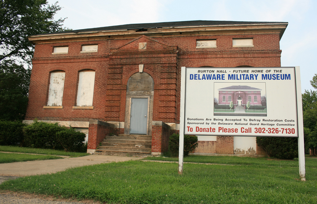 DelawareMilitaryMuseum
 DeFlaviis takes command 090208-A-DL064-633
 Chesapeake and Delaware Canal eastern entrance
 Map of the country between Bladensburg and Fort Dupont with contours of ground - showing location of Fort Lincoln, Battery Jamieson, Fort Mahan, Fort Chapein, Fort Meigs, Redoubt Rucker, and Fort Dupont - NARA - 122207840
 Rifle Pits
 FT. DUPONT, DELAWARE CITY, NEW CASTLE COUNTY, DE
 FORT DUPONT HISTORIC DISTRICT, NORTHERN NEW CASTLE COUNTY, DE
 FORT DUPONT, N. NEW CASTLE COUNTY, DE
 FORT DUPONT, NORTH NEW CASTLE COUNTY, DELAWARE
 FT. DUPONT, DELAWARE CTY, NEW CASTLE COUNTY, DE
| Type | Subtype | Date | Description | Notes | Source |
|---|---|---|---|---|---|
| event | armed conflict | 1655 | Invasion of New Sweden | Dutch Republic, Swedish Empire, invasion | Wikidata |
| event | armed conflict | 1777 | Battle of Cooch's Bridge | United States, Kingdom of Great Britain, battle | Wikidata |
| event | armed conflict | 1778 | Battle of Quinton's Bridge | United States, Kingdom of Great Britain, battle | Wikidata |
| event | war | 1655 | Dutch conquest of New Sweden | Sweden, Dutch Republic, battle, invasion, annexation, landing operation, bloodless war | Wikidata |
| link | page | National Register of Historic Places listed place page@ | Wikidata | ||
| link | page | National Register of Historic Places page@ | Wikidata | ||
| link | page | FortWiki page@ | Wikidata | ||
| organisation | shipbuilding | 1837 | Harlan and Hollingsworth | shipbuilding, business | Wikidata |
| site | fort | Fort Delaware | fort, military prison, Union Army | Wikidata | |
| site | fort | Fort Elfsborg | fort | Wikidata | |
| site | fort | 1638 | Fort Christina | fort | Wikidata |
| site | fort | 1651 | Fort Casimir | fort | Wikidata |
| site | fort | 1863 | Fort DuPont | fort | Wikidata |
| site | fort | 1872 | Fort Mott State Park | artillery fort, New Jersey state park, New Jersey Division of Parks and Forestry | Wikidata |
| commons | image | DelawareMilitaryMuseum | Commons | ||
| commons | image | DeFlaviis takes command 090208-A-DL064-633 | Commons | ||
| commons | image | Chesapeake and Delaware Canal eastern entrance | Commons | ||
| commons | image | Map of the country between Bladensburg and Fort Dupont with contours of ground - showing location of Fort Lincoln, Battery Jamieson, Fort Mahan, Fort Chapein, Fort Meigs, Redoubt Rucker, and Fort Dupont - NARA - 122207840 | Commons | ||
| commons | image | Rifle Pits | Commons | ||
| commons | image | FT. DUPONT, DELAWARE CITY, NEW CASTLE COUNTY, DE | Commons | ||
| commons | image | FORT DUPONT HISTORIC DISTRICT, NORTHERN NEW CASTLE COUNTY, DE | Commons | ||
| commons | image | FORT DUPONT, N. NEW CASTLE COUNTY, DE | Commons | ||
| commons | image | FORT DUPONT, NORTH NEW CASTLE COUNTY, DELAWARE | Commons | ||
| commons | image | FT. DUPONT, DELAWARE CTY, NEW CASTLE COUNTY, DE | Commons | ||