Fort de La Présentation
From Warlike
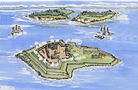
The Fort de La Présentation, a mission fort, was built in 1749 and so named by the French Sulpician priest, Abbé Picquet. It was also sometimes known as Fort La Galette. It was built at the confluence of the Oswegatchie River and the St Lawrence River in present-day New York. The French wanted to strengthen their alliance with the powerful Iroquois, as well as convert them to Catholicism. With increasing tensions with Great Britain, they were concerned about their thinly populated Canadian colony. By 1755 the settlement included 3,000 Iroquois residents loyal to France, in part because of the fur trade, as well as their hostility to encroachment by British colonists in their other territories. By comparison, Montréal had only 4,000 residents.
1749 Website,
Wikimedia, Wikidata
Fort La Galette; Fort Oswegatchie; Fort de La Presentation
United States, United States, 
- Facebook channel@
- National Register of Historic Places listed place page@
- National Register of Historic Places page@
- FortWiki page@
- Starforts page@
Location: 44.6956, -75.5008, KML, Cluster Map, Maps,
6 places
-

Battle of Ogdensburg ⓘ
war of 1812 battle -

Battle of the Windmill ⓘ
1838 battle -

Fort Wellington ⓘ
historic military fortification in Ontario, Canada -

Fort de La Présentation ⓘ
French fort in upstate New York -
Fort Lévis ⓘ
fort in Canada -

Battle of the Windmill National Historic Site ⓘ
historic site in Ontario, Canada
 This painting was done a Fort de La Presentation and is incorrectly labeled a at La Galette which is further down the river
 Cartes et plans du secrétariat d'Etat à la marine, du Dépôt des Fortifications des Colonies et de l'Atlas Moreau de Saint-Méry (Archives nationales d'outre-mer). Atlas Moreau de Saint Méry. - btv1b10104592t
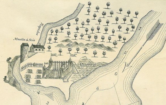 Fort de La Présentation
| Type | Subtype | Date | Description | Notes | Source |
|---|---|---|---|---|---|
| event | armed conflict | 1813 | Battle of Ogdensburg | United States, battle, United Kingdom of Great Britain and Ireland | Wikidata |
| event | armed conflict | 1838 | Battle of the Windmill | battle | Wikidata |
| link | channel | Facebook channel@ | Wikidata | ||
| link | page | National Register of Historic Places listed place page@ | Wikidata | ||
| link | page | National Register of Historic Places page@ | Wikidata | ||
| link | page | FortWiki page@ | Wikidata | ||
| link | page | Starforts page@ | Wikidata | ||
| site | fort | Fort Wellington | military museum, fort | Wikidata | |
| site | fort | 1749 | Fort de La Présentation | archaeological site, fort | Wikidata |
| site | fort | 1759 | Fort Lévis | fort | Wikidata |
| site | museum | Battle of the Windmill National Historic Site | National Historic Site Administered by Parks Canada, battlefield, military museum | Wikidata | |
| commons | image | This painting was done a Fort de La Presentation and is incorrectly labeled a at La Galette which is further down the river | Commons | ||
| commons | image | Cartes et plans du secrétariat d'Etat à la marine, du Dépôt des Fortifications des Colonies et de l'Atlas Moreau de Saint-Méry (Archives nationales d'outre-mer). Atlas Moreau de Saint Méry. - btv1b10104592t | Commons | ||
| commons | image | Fort de La Présentation | Commons | ||
._Atlas_Moreau_de_Saint_M%C3%A9ry._-_btv1b10104592t.jpg)