Fort Strong
From Warlike
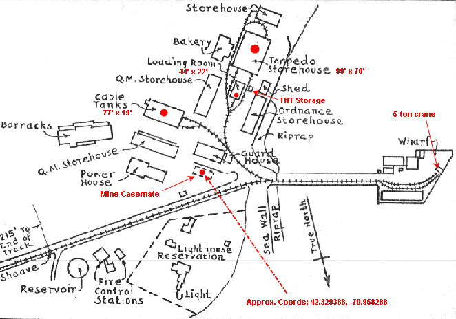
Fort Strong is a former U.S. Army Coast Artillery fort that occupied the northern third of Long Island in the Boston Harbor. The island had a training camp during the American Civil War, and a gun battery was built there in the 1870s. The fort was built in 1893-1906 during the Endicott period of expansion in U.S. coast defense, and was part of the Coast Defenses of Boston. Formerly, it was also known as Long Island Military Reservation. Before World War I, a large station for handling submarine mines was added to the fort's defenses. Prior to World War I the fort was probably manned by over 1,000 soldiers. During World War II, two batteries of 3-inch guns defended channel minefields, but the big guns and other 3-inch batteries were decommissioned. Declared surplus in 1947, the fort served as a Nike missile site until 1961, and was redeveloped in 2005-2009 for a children's summer camp and later a homeless shelter. However, in 2014 the island's bridge was demolished due to safety concerns, and all activity ended.
1899
Wikimedia, Wikidata
United States, United States, 
- FortWiki page@
Location: 42.33, -70.956, KML, Cluster Map, Maps,
31 places
-

1689 Boston revolt ⓘ
April 1689 revolt in Boston -
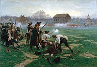
Battle of Lexington ⓘ
1775 battle in Lexington, Massachusetts at the very start of the American Revolutionary War -

Battle of Menotomy ⓘ
early battle of the American Revolutionary War -

Battles of Lexington and Concord ⓘ
first military engagements of the American Revolutionary War (1775) -

Siege of Boston ⓘ
1775 the Continental Army's siege of British-held Boston during the beginning of the American Revolutionary War -

Battle of Chelsea Creek ⓘ
1775 battle of the American Revolutionary War -
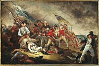
Battle of Bunker Hill ⓘ
1775 early battle of the American Revoluntionary War -

Fortification of Dorchester Heights ⓘ
military action of the American Revolutionary War -

Beverly Fort ⓘ
fort in Beverly, Massachusetts, U.S -
Fort Andrew ⓘ


-

Fort Glover ⓘ
fort in Massachusetts -

Fort Heath ⓘ
US seacoast military installation for defense -

Fort Juniper ⓘ
military fort in Massachusetts during the American Revolutionary War. -

Fort Sewall ⓘ
fort in Massachusetts

-

Fort Warren ⓘ
fort in Boston Harbor

-
Fort Washington ⓘ
historic fort in Massachusetts, USA -

Fort Miller ⓘ
coastal defense fort in Marblehead, Massachusetts, in existence circa 1630-1900 -
Fort Independence ⓘ
fort on Castle Island in South Boston, Massachusetts -

Fort Revere ⓘ
fort in Massachusetts
-

Fort Winthrop ⓘ
fort in Massachusetts -

Fort Andrews ⓘ
part of the defenses of Boston, Massachusetts, USA -

Fort Standish ⓘ
fort in Boston, Massachusetts -

Fort Strong ⓘ
historic fort in Massachusetts, USA -

Fort Duvall ⓘ
fort in Massachusetts -

Fort Ruckman ⓘ
U.S. Coast Artillery fort located in Nahant, Massachusetts -

Fort Dawes ⓘ
-

Bunker Hill Monument ⓘ
military museum
| Type | Subtype | Date | Description | Notes | Source |
|---|---|---|---|---|---|
| event | armed conflict | 1689 | 1689 Boston revolt | rebellion | Wikidata |
| event | armed conflict | 1775 | Battle of Lexington | battle | Wikidata |
| event | armed conflict | 1775 | Battle of Menotomy | battle | Wikidata |
| event | armed conflict | 1775 | Battles of Lexington and Concord | Kingdom of Great Britain, battle, Thirteen Colonies | Wikidata |
| event | armed conflict | 1775 | Siege of Boston | siege | Wikidata |
| event | armed conflict | 1775 | Battle of Chelsea Creek | United States, Kingdom of Great Britain, battle | Wikidata |
| event | armed conflict | 1775 | Battle of Bunker Hill | United States, Kingdom of Great Britain, battle | Wikidata |
| event | armed conflict | 1776 | Fortification of Dorchester Heights | battle | Wikidata |
| link | page | FortWiki page@ | Wikidata | ||
| object | watercraft | Magnifique | Magnifique-class ship of the line, ship of the line | Wikidata | |
| object | watercraft | USS Boston | Boston-class cruiser, guided missile cruiser, Baltimore-class cruiser | Wikidata | |
| object | watercraft | USS Princeton | steamship | Wikidata | |
| object | watercraft | USS Salem | preserved watercraft, heavy cruiser, United States Navy | Wikidata | |
| organisation | arms industry | United Shoe Machinery Corporation | arms industry, concern, business, Manufacture of machinery for textile, apparel and leather production | Wikidata | |
| organisation | arms industry | 1892 | General Electric | mechanical engineering, automotive industry, finance lease, arms industry, conglomerate, public company, power engineering, aircraft industry, business, enterprise | Wikidata |
| organisation | arms industry | 1932 | Charles Stark Draper Laboratory | nonprofit organization, arms industry, laboratory | Wikidata |
| organisation | factory | Bethlehem Atlantic Works | shipyard, shipbuilding | Wikidata | |
| organisation | factory | Bethlehem Hingham Shipyard | shipbuilding, shipyard | Wikidata | |
| organisation | factory | 1900 | Fore River Shipyard | shipbuilding, shipyard | Wikidata |
| organisation | shipbuilding company | 1866 | George Lawley & Son | shipbuilding, shipbuilding company | Wikidata |
| site | fort | Beverly Fort | fort | Wikidata | |
| site | fort | Fort Andrew | fort | Wikidata | |
| site | fort | Fort Glover | fort | Wikidata | |
| site | fort | Fort Heath | sea fort | Wikidata | |
| site | fort | Fort Juniper | fort | Wikidata | |
| site | fort | Fort Sewall | fort | Wikidata | |
| site | fort | Fort Warren | fort | Wikidata | |
| site | fort | Fort Washington | earthworks, fort, Continental Army, park | Wikidata | |
| site | fort | 1629 | Fort Miller | fort | Wikidata |
| site | fort | 1643 | Fort Independence | fort | Wikidata |
| site | fort | 1776 | Fort Revere | artillery fort | Wikidata |
| site | fort | 1808 | Fort Winthrop | fort | Wikidata |
| site | fort | 1897 | Fort Andrews | artillery fort | Wikidata |
| site | fort | 1899 | Fort Standish | Massachusetts Department of Conservation and Recreation, fort | Wikidata |
| site | fort | 1899 | Fort Strong | fort | Wikidata |
| site | fort | 1920 | Fort Duvall | fort | Wikidata |
| site | fort | 1924 | Fort Ruckman | fort | Wikidata |
| site | fort | 1942 | Fort Dawes | fort | Wikidata |
| site | museum | USS Cassin Young | preserved watercraft, museum ship, destroyer, United States Navy | Wikidata | |
| site | museum | 1797 | USS Constitution | preserved watercraft, museum ship, frigate, United States Navy, tripadvisor | Wikidata |
| site | museum | 1800 | Boston Navy Yard | military museum, maritime museum, shipyard, United States Navy | Wikidata |
| site | museum | 1843 | Bunker Hill Monument | monument, military museum, obelisk | Wikidata |
| site | museum | 1993 | United States Naval Shipbuilding Museum | military museum, maritime museum | Wikidata |
| commons | image | Ft-Strong-Obsolete-Bty | Commons | ||
| commons | image | Strong-Mine-Handling | Commons | ||
| commons | image | Strong-Mines-S | Commons | ||
| commons | image | Long Island - Boston Harbor - 100708 - b - 067-300 | Commons | ||
| commons | image | Long Island - Boston Harbor - 100708 - a - 035-300 | Commons | ||
| commons | image | Long Island - Boston Harbor - 100708 - b - 075-300 | Commons | ||
| commons | image | Long Island - Boston Harbor - 100708 - a - 037-300 | Commons | ||
| commons | image | Basinger-CRF | Commons | ||
| commons | image | Battery-Smyth | Commons | ||


