Fort Meigs
From Warlike
Fort Meigs was a United States fortification along the Maumee River in what is now Perrysburg, Ohio built during the War of 1812. The British, supported by Tecumseh's Confederacy, failed to capture the fort during the siege of Fort Meigs. It is named in honor of Ohio governor Return J. Meigs Jr., for his support in providing Major General William Henry Harrison with militia and supplies for a line of forts in Ohio and the Indiana Territory. The site is owned by the Ohio History Connection.
Website,
Wikimedia, Wikidata
United States, Fort Meigs State Memorial, United States, 
- National Register of Historic Places listed place page@
- National Register of Historic Places page@
- FortWiki page@
- Starforts page@
- Tripadvisor page@
Location: 41.5528, -83.6517, KML, Cluster Map, Maps, ![]()
![]()
5 places
-

Battle of Fort Wayne ⓘ
1790 battle -

Battle of Fallen Timbers ⓘ
battle fought in 1794 -

Siege of Fort Meigs ⓘ
siege during the War of 1812 -

Fort Meigs ⓘ
historic fort in Ohio, USA

-

Fort Miami ⓘ
fort built on the Maumee River
{"selectable":false,"showCurrentTime":false,"width":"100%","zoomMin":100000000000}
 Battle of Fort Meigs, Perrysburg, Ohio, 1812 - DPLA - 43efc2bb398c30eba002141e1649e745
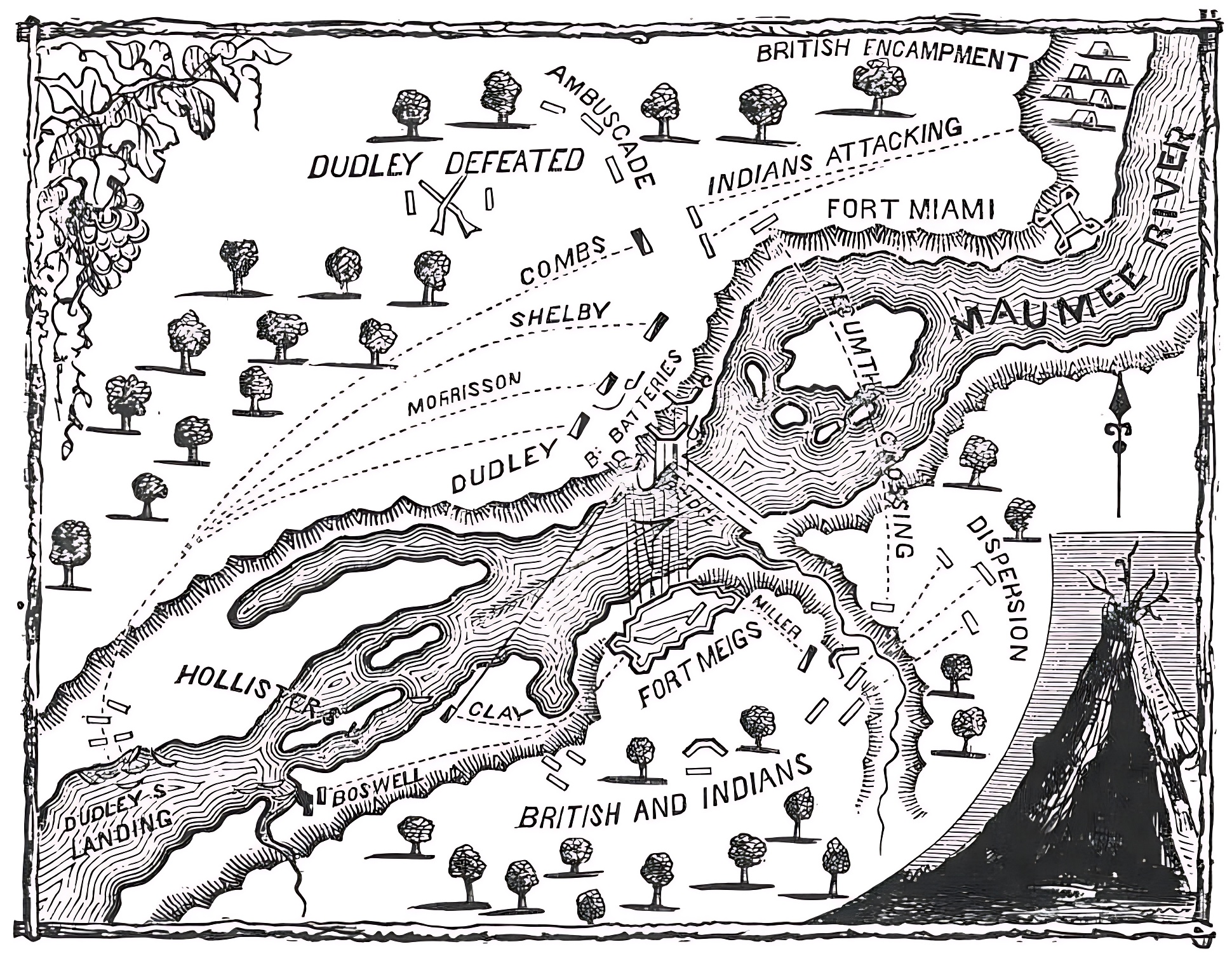 MeigsBattle
 Earthworks of Fort Meigs, Perrysburg, Ohio, 1894 - DPLA - e52506b7dd5935140bfe23726f0aa8f4
 FortMeigsGuides
 Fort Meigs, Perrysburg, Ohio (approximately 1900) - DPLA - cac5677f5bad29f8d4b7516d0175ee48
 Map of the country between Bladensburg and Fort Dupont with contours of ground - showing location of Fort Lincoln, Battery Jamieson, Fort Mahan, Fort Chapein, Fort Meigs, Redoubt Rucker, and Fort Dupont - NARA - 122207840
 Fort Meigs Grand Traverse, Perrysburg, Ohio, 1918 - DPLA - 8abb5168feb3b4164a7a91922479c76e
 Plan of Fort on Stone's Farm at fork of Marlboro Roads (Fort Meigs) - DPLA - 0c8f657917bf05d08da8349be7d9463a
 1813 Map of the Rapids of Miami, showing Fort Meigs
 Plan of Fort Meigs' and its environs - compricing (sic) the operations of the American forces, under Genl. W.H. Harrison, and the British Army and their allies, under Genl. Proctor and Tecumseh LOC 2004625488
_-_DPLA_-_cac5677f5bad29f8d4b7516d0175ee48.jpg)
_-_DPLA_-_0c8f657917bf05d08da8349be7d9463a.jpg)
_the_operations_of_the_American_forces,_under_Genl._W.H._Harrison,_and_the_British_Army_and_their_allies,_under_Genl._Proctor_and_Tecumseh_LOC_2004625488.jpg)