Fort Independence
From Warlike
Fort Independence, originally named Camp Independence, was a fort located in the Owens Valley, 3 miles (4.8 km) north of present-day Independence, Inyo County, eastern California. The U.S. Army post was active from 1862 to 1877.
1862
Wikimedia, Wikidata
United States, United States, 
Location: 36.8253, -118.3717, KML, Cluster Map, Maps,
2 places
-

Owens Valley Indian War ⓘ
1862–1863 armed conflict between Native Americans and settlers -

Fort Independence ⓘ
U.S. Cavalry fort during the 1860s, now site of the Fort Independence Indian Reservation near Independence, California
1862-07-04T00:00:00Z
1862-07-04T00:00:00Z
1862 Fort Independence
{"selectable":false,"showCurrentTime":false,"width":"100%","zoomMin":100000000000}
 CAMP INDEPENDENCE, SIERRA NEVADA, CALIFORNIA - NARA - 524155
 CAMP INDEPENDENCE, SIERRA NEVADA, CALIFORNIA - NARA - 524157
 CAMP INDEPENDENCE, SIERRA NEVADA, CALIFORNIA - NARA - 524156
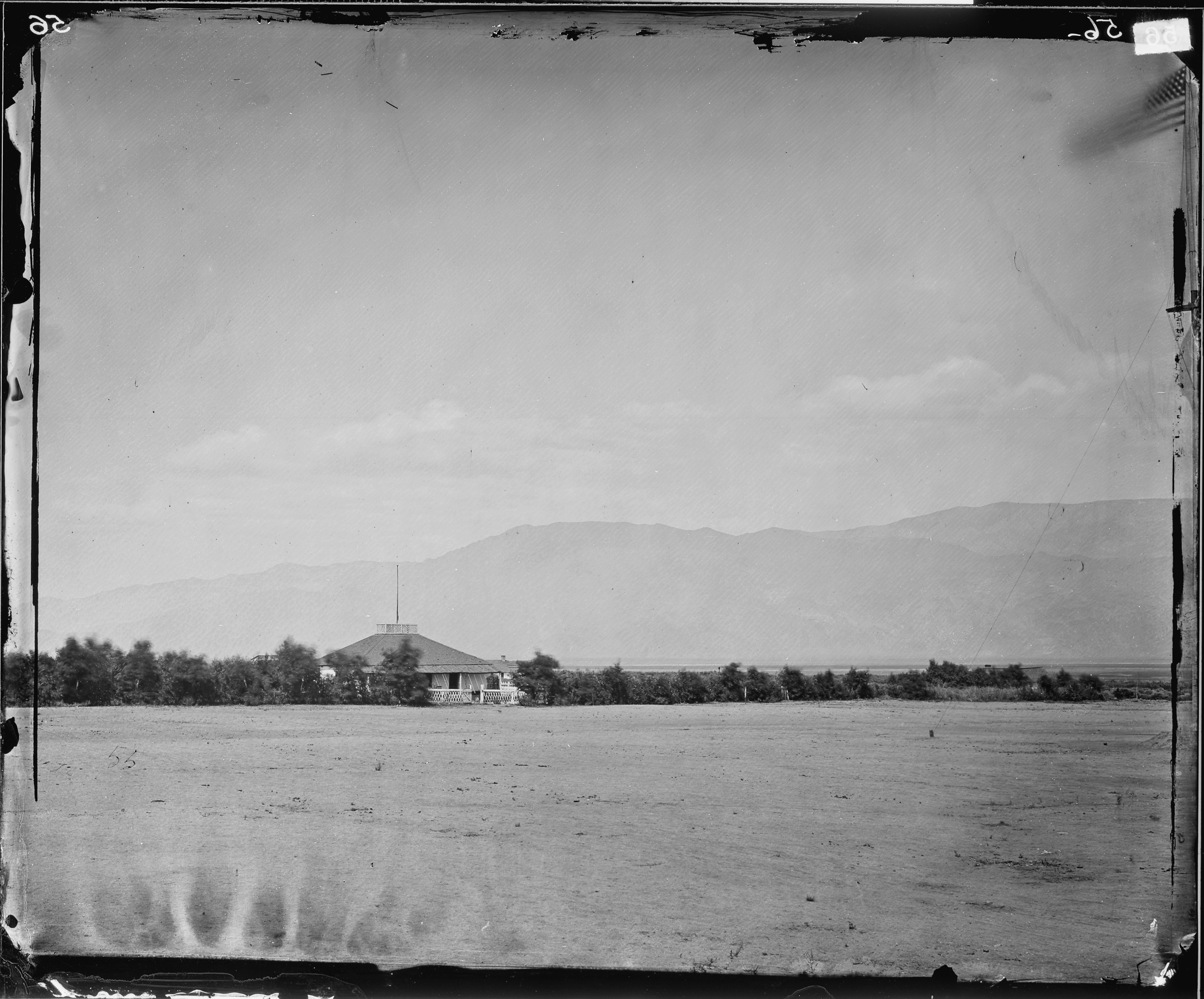 CAMP INDEPENDENCE, HOSPITAL, SIERRA NEVADA, CALIFORNIA - NARA - 524159
 Camp Independence Bronze Plaque
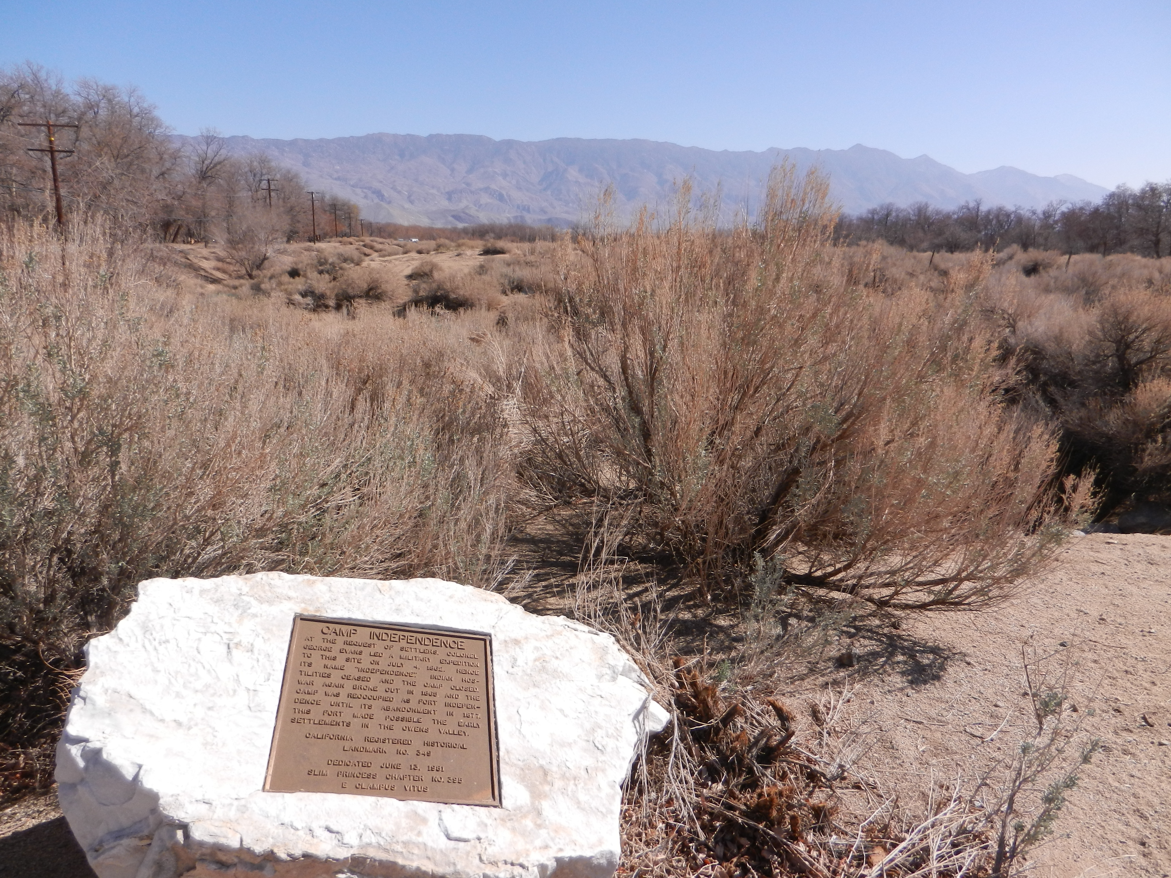 Camp Independence Site
| Type | Subtype | Date | Description | Notes | Source |
|---|---|---|---|---|---|
| event | armed conflict | 1862 | Owens Valley Indian War | armed conflict | Wikidata |
| link | page | California Office of Historic Preservation Historical Resources page@ | Wikidata | ||
| link | page | FortWiki page@ | Wikidata | ||
| site | fort | 1862 | Fort Independence | fort, Fort Independence Indian Community of Paiute Indians | Wikidata |
| commons | image | CAMP INDEPENDENCE, SIERRA NEVADA, CALIFORNIA - NARA - 524155 | Commons | ||
| commons | image | CAMP INDEPENDENCE, SIERRA NEVADA, CALIFORNIA - NARA - 524157 | Commons | ||
| commons | image | CAMP INDEPENDENCE, SIERRA NEVADA, CALIFORNIA - NARA - 524156 | Commons | ||
| commons | image | CAMP INDEPENDENCE, HOSPITAL, SIERRA NEVADA, CALIFORNIA - NARA - 524159 | Commons | ||
| commons | image | Camp Independence Bronze Plaque | Commons | ||
| commons | image | Camp Independence Site | Commons | ||