Rofalco
From Warlike
Rofalco was a fortified late-Etruscan settlement, located about twenty km north of Vulci, at the edge of the Selva del Lamone volcanic plateau. The site controlled the important natural route formed by the valley of the Olpeta stream and contributed to the defense and the organization of the southeastern portion of the ancient territory of Vulci.
-350 — -300
Wikimedia, Wikidata
Italy, Italy, 

-
Location: 42.5703, 11.7131, KML, Cluster Map, Maps,
4 places
-

Battle of Montorio ⓘ
1486 battle -

Wars of Castro ⓘ
conflict between the Papacy and the Farnese dukes of Parma -

Fortezza Orsini ⓘ
Fortification in the Italian community of Sorano -

Rofalco ⓘ
late-Etruscan settlement
{"selectable":false,"showCurrentTime":false,"width":"100%","zoomMin":100000000000}
 Planimetria RofalcoPlanimetria Rofalco
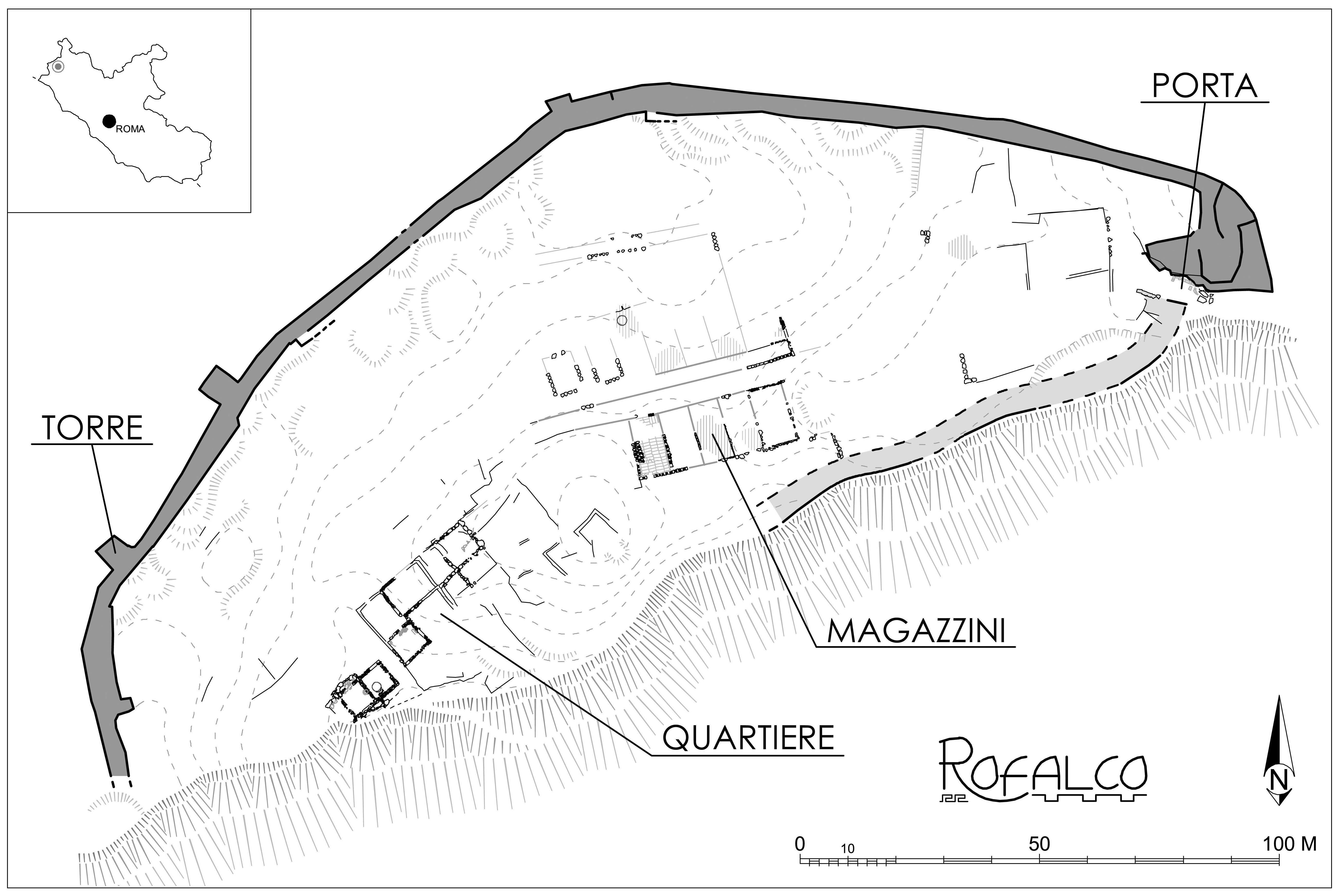
 Plan of the Etruscan Fortress of Rofalco, with main settlement areas (Rofalco Project Archive, 2013).Plan of the Etruscan Fortress of Rofalco, with main settlement areas (Rofalco Project Archive, 2013).
 Plan of the Etruscan Fortress of Rofalco, with main settlement areas (Rofalco Project Archive, 2020).Plan of the Etruscan Fortress of Rofalco, with main settlement areas (Rofalco Project Archive, 2020).
| Type | Subtype | Date | Description | Notes | Source |
|---|---|---|---|---|---|
| event | armed conflict | 1486 | Battle of Montorio | battle | Wikidata |
| event | war | 1641 | Wars of Castro | war, Innocent X, Urban VIII, Duchy of Parma and Piacenza, Duchy of Castro | Wikidata |
| site | fort | Fortezza Orsini | fortress | Wikidata | |
| site | fort | 350 | Rofalco | fort, Gruppo Archeologico Romano, tourist attraction, archaeological site | Wikidata |
| commons | image | Planimetria Rofalco | Commons | ||
| commons | image | Planimetria Rofalco | Commons | ||
| commons | image | Plan of the Etruscan Fortress of Rofalco, with main settlement areas (Rofalco Project Archive, 2013). | Commons | ||
| commons | image | Plan of the Etruscan Fortress of Rofalco, with main settlement areas (Rofalco Project Archive, 2013). | Commons | ||
| commons | image | Plan of the Etruscan Fortress of Rofalco, with main settlement areas (Rofalco Project Archive, 2020). | Commons | ||
| commons | image | Plan of the Etruscan Fortress of Rofalco, with main settlement areas (Rofalco Project Archive, 2020). | Commons | ||