Fort Adams
From Warlike
1790s fort in Wilkinson County, Mississippi
Wikimedia, Wikidata
Davion's Rock; Fort at Loftus Heights; Ft. Adams
 ,
, 
Location: 31.16, -91.32, KML, Cluster Map, Maps,
1 places
-

Fort Adams ⓘ
1790s fort in Wilkinson County, Mississippi
 Detail of 1800 United States survey of Natchez District near Fort Adams
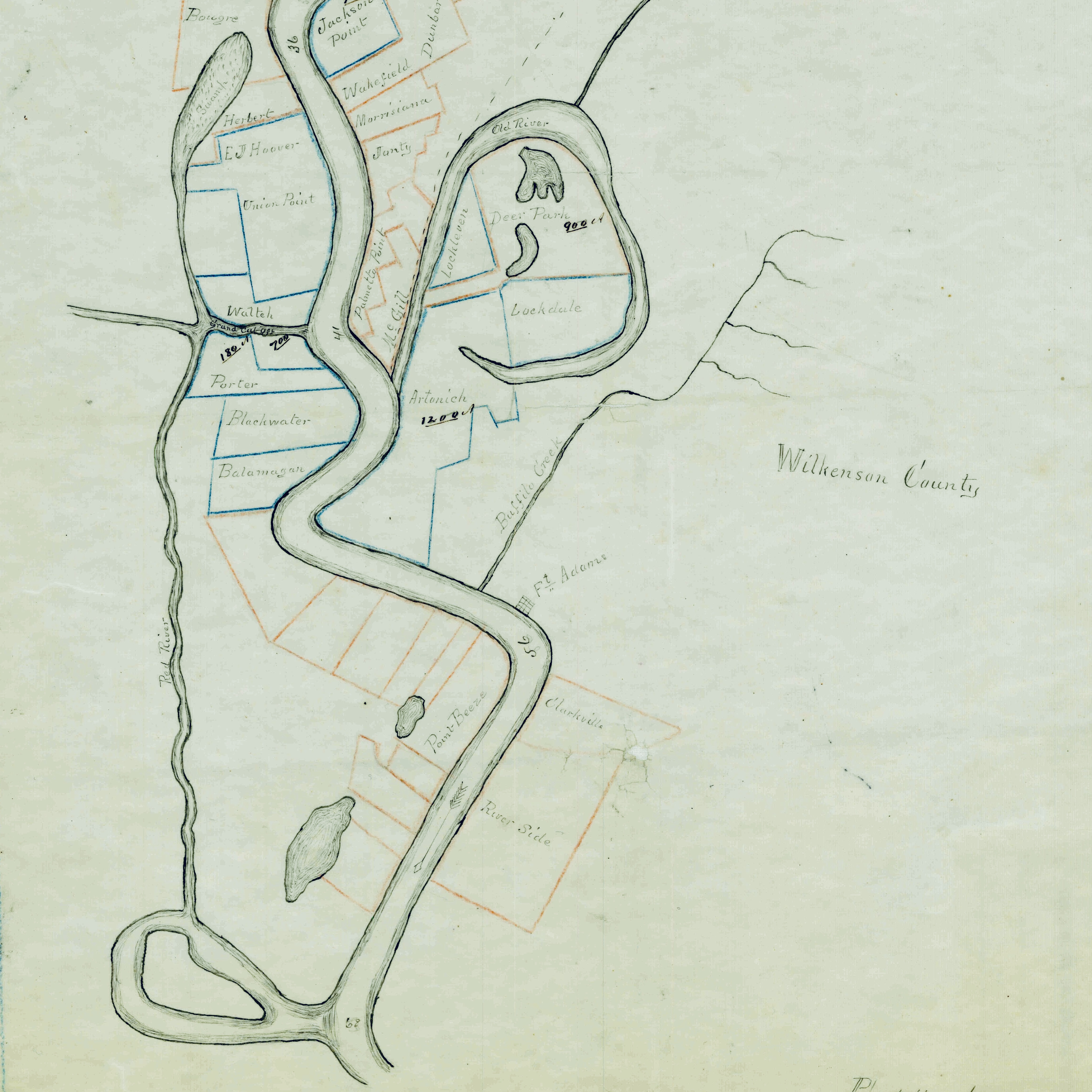 Fort Adams, Mississippi late 1860s
 A Plan of an Embrasur and Platform. - A Section of the Parapet, through an Embrasure and Platform. - A Section of the ground at Loftus's Heights extending from high-water in the River Mississippi thro' the plane(...) - NARA - 102279871
 A Plan of Fort Adams at Loftus's Heights on the River Mississippi - DPLA - 15496472a056245788fa2f46d44aa3e2
 A Section of the Ground at Loftus's Heights Extending from High Water in the River Mississppi through the Planes Whereon the Principal Garrison & Batteries are to be Erected - NARA - 102279865
 Plan Proposed for the upper works of Fort Adams Miss. Loftus Heights, on the Mississippi - NARA - 102279873
 A copy of the plat comprehending Loftus's Heights, and, Fort Adams, containing 45 Acres - NARA - 102279863
 The western pilot - containing charts of the Ohio River, and of the Mississippi, from the mouth of the Missouri to the Gulf of Mexico; accompanied with directions for navigating the same, and a (14767956514)
 FortAdamsMississippiMapA Section of the Ground at Loftus's Heights Extending from High Water in the River Mississppi through the Planes Whereon the Principal Garrison & Batteries are to be Erected - NARA - 102279865
_-_NARA_-_102279871.jpg)
.jpg)