Karte Haus Burgund 5.png
From Warlike
File:Karte Haus Burgund 5.png
Size of this preview: 402 × 599 pixels. Other resolutions: 161 × 240 pixels | 322 × 480 pixels | 516 × 768 pixels | 1,200 × 1,787 pixels.
Original file (1,200 × 1,787 pixels, file size: 449 KB, MIME type: image/png)
Summary
| Description |
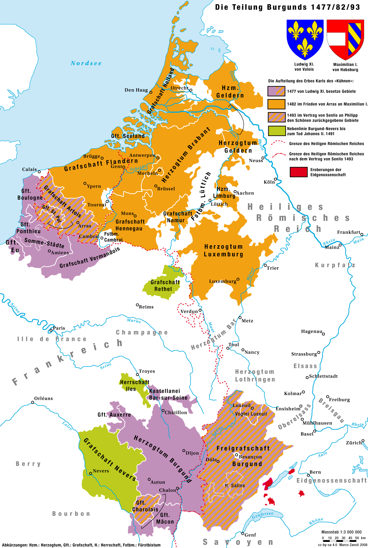
Deutsch: Die Aufteilung des Herrschaftsgebiet Karl I., «des Kühnen», zwischen Frankreich und Habsburg zwischen 1477 und 1493 |
|
| Date | ||
| Source | Own work | |
| Author | Marco Zanoli (sidonius 16:15, 26 April 2008 (UTC)) | |
| Permission (Reusing this file) |
|
|
| Other versions |
|


File history
Click on a date/time to view the file as it appeared at that time.
| Date/Time | Thumbnail | Dimensions | User | Comment | |
|---|---|---|---|---|---|
| current | 16:04, 28 May 2018 | | 1,200 × 1,787 (449 KB) | wikimediacommons>Sidonius | - kleinere Fehler korrigiert |
File usage
The following 16 pages use this file:
- War of the Burgundian Succession
- Hundred Years' War
- Algerian War
- War of the Burgundian Succession
- War of the Burgundian Succession
- Edwardian War
- Second French War of Religion
- Siege of Bourges
- Battle of Beaugency
- Battle of Déols
- Caroline War
- Lancastrian War
- Siege of Avaricum
- Franco-Prussian War
- Repression of the Commune
- Siege of Bourges