Fort McRee
From Warlike
Q1438620
Former fort near Pensacola, Florida
Wikimedia, Wikidata
destroyed building or structure, fort, United States of America, 
- Freebase entry@
- FortWiki article@
- Fort McRee, Florida (NAID 103396661)@
- Map Showing Military Reservation of Fort McRee and a Portion of each of the Reservations of Forts Barrancas and Pickens (NAID 77452256)@
Location: 30.325833333, -87.316944444, ///teams.pieced.plucked, Google, Bing, Aerial View, OldMapsOnline, ESRI Imagery, Historic Markers, KML
- All fortification sites
- All maritime sites
- All subterranean sites
- All weapon sites
- All military sites
 Confederate battery north of Fort McRee at Pensacola, Florida
 Entrance to Pensacola Bay 1862 from Colton's maps of U.S. harbors
 Florida - Fort McRee
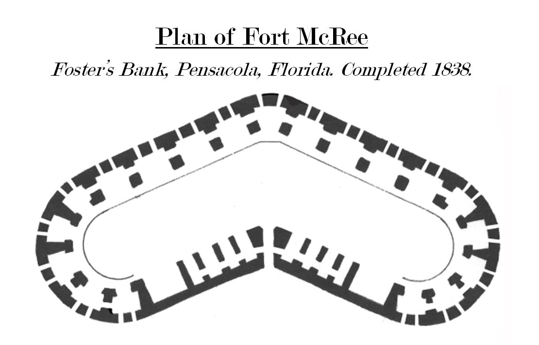 Fort McRee Diagram
 Fort McRee Water Battery
 Fort McRee in background, Memorial Day Weekend 2007 - panoramio
 Fort Pickens - Pensacola Harbor, Florida - Currier & Ives
 Nps pensacola bay sketch.PNG
 Relief of Fort Pickens, by the United States fleet, March 23, 1861 - sketched from the wheel-house of the Atlantic by an officer of the expedition. LCCN90711028
 Relief of Fort Pickens, by the United States fleet, March 23, 1861 - sketched from the wheel-house of the Atlantic by an officer of the expedition. (cropped) LCCN90711028 (cropped)
 The photographic history of the Civil War - thousands of scenes photographed 1861-65, with text by many special authorities (1911) (14782694503)
%20(14762797155).jpg)
%20LCCN90711028%20(cropped).jpg)
%20(14782694503).jpg)