Fort St. Philip
From Warlike
Q5472085
Plaquemines Parish, Louisiana
Wikimedia, Wikidata
fort, United States of America, 
Location: 29.3639, -89.4628, ///consumers.greatness.unfortunate, Google, Bing, Aerial View, OldMapsOnline, ESRI Imagery, Historic Markers, KML
- All fortification sites
- All maritime sites
- All subterranean sites
- All weapon sites
- All military sites
1815-01-09T00:00:00Z
{"selectable":false,"width":"1000px","zoomMin":100000000000}
 495 of 'Historical memoir of the war in West Florida and Louisiana in 1814-15. With an atlas ... written originally in French, and translated ... by H. P. Nugent' (11003442304)
 1862 map detail, Reconnoissance of the Mississippi River below Forts Jackson and St. Philip - made previous to the reduction by the U.S. Fleet, under the command of flag officer D.G. Farragut, U.S.N. LOC 86691337 (cropped)
 America, from discovery in 1942 to the present time (1894) (14741793656)
 Butler's victims of Fort St. Philip LCCN90710013
 FortStPhilipAir1935
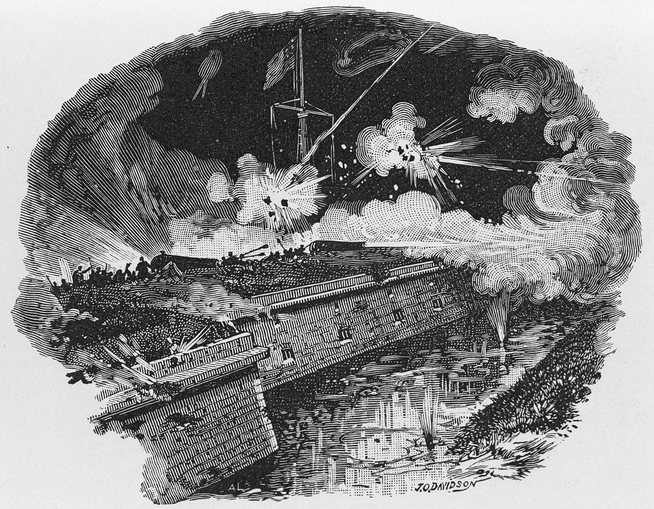 FortStPhilipDavidsonCIvilWar
 FortStPhilipNPS1898Addition
 FortStPhilipNPSSallyPort
 FortStPhilipOvergrownEarthworksNPS
 FortStPhilipOvergrownNPSA
 FortStPhilipRiverLeveeNPS
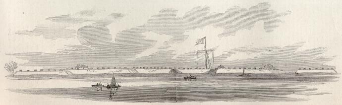 Fort Saint Phillip 1862 Harpers
 Fort St. Philip
 LC-USZC2-2124 (17790557958)
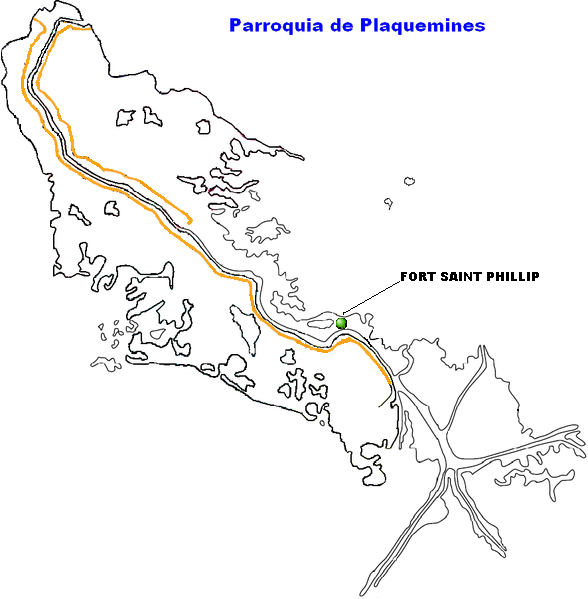 LocalizadorFortSaintPhillip.PNG
 Plan and Profiles of the Fort St. Philip. at the Plaquemines bend
 Plan of Fort St. Philip, Louisiana
 Plan of Fort St. Philip, with projected improvements
 Reconnaissance of Forts Jackson and St. Philip, on the Mississippi, by Gun-boats from Flag-officer Farragut's Squadron NH 59066
 Reconnoissance of the Mississippi River below Forts Jackson and St. Philip - made previous to the reduction by the U.S. Fleet, under the command of flag officer D.G. Farragut, U.S.N. LOC 86691337
 The Opening of the lower Mississippi and the capture of New Orleans. Section of Fort St. Philip during the engagement - A.L., sc. ; J.O. Davidson. LCCN92514947
 USS Kennebec(1862)
.jpg)
.jpg)
%20(14741793656).jpg)
.jpg)
.png)