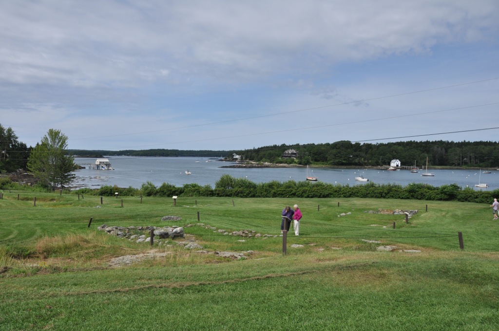
Pemaquid Archeological Site
From Warlike
Colonial Pemaquid State Historic Site is a publicly owned historic property operated by the state of Maine near Pemaquid Beach in Bristol, Maine. The site includes the reconstructed Fort William Henry, archaeological remains of 17th- and 18th-century village buildings and fortifications, and a museum with artifacts found on the site including musket balls, coins, pottery, and early hardware.
Website,
Wikimedia, Wikidata
Colonial Pemaquid State Historic Site
United States, United States, 
- National Register of Historic Places listed place page@
- National Register of Historic Places page@
- FortWiki page@
- Tripadvisor page@
Location: 43.8781, -69.5214, KML, Cluster Map, Maps, ![]()
![]()
8 places
-

Siege of Pemaquid ⓘ
1689 action of King William's War -

Siege of Pemaquid ⓘ
1696 action of King William's War -

Fort Menaskoux ⓘ
British colonial fort in present-day Maine, United States -

Fort William Henry ⓘ
fort in Maine -

Pemaquid Archeological Site ⓘ
historic district in Maine, United States

-

Fort Popham ⓘ
coastal defense land battery in Maine, United States -

Fort Baldwin ⓘ
coastal defence and fortification in Phippsburg, Maine
1813-09-05T00:00:00Z
1813-09-05T00:00:00Z
{"selectable":false,"showCurrentTime":false,"width":"100%","zoomMin":100000000000}
| Type | Subtype | Date | Description | Notes | Source |
|---|---|---|---|---|---|
| event | armed conflict | 1689 | Siege of Pemaquid | siege | Wikidata |
| event | armed conflict | 1696 | Siege of Pemaquid | siege | Wikidata |
| event | armed conflict | 1813 | Capture of HMS Boxer | naval battle | Wikidata |
| link | page | National Register of Historic Places listed place page@ | Wikidata | ||
| link | page | National Register of Historic Places page@ | Wikidata | ||
| link | page | FortWiki page@ | Wikidata | ||
| link | page | Tripadvisor page@ | Wikidata | ||
| organisation | factory | 1884 | Bath Iron Works | shipbuilding, shipyard | Wikidata |
| site | fort | Fort Menaskoux | fort | Wikidata | |
| site | fort | Fort William Henry | fort | Wikidata | |
| site | fort | Pemaquid Archeological Site | state historic site in the United States, archaeological site, fort | Wikidata | |
| site | fort | 1857 | Fort Popham | memorial, fort | Wikidata |
| site | fort | 1905 | Fort Baldwin | fort | Wikidata |
| commons | image | Fort Rock and Castle Wall Foundations, Pemaquid Beach, ME | Commons | ||
| commons | image | Maine in history and romance (1915) (14580115238) | Commons | ||
| commons | image | PemaquidME PineTreeSixpence | Commons | ||
| commons | image | PemaquidME FishHooks | Commons | ||
| commons | image | PemaquidME ArcheologicalSite | Commons | ||
| commons | image | PemaquidME PineTreeSixpence | Commons | ||
| commons | image | PemaquidME ChamberPot | Commons | ||
| commons | image | PemaquidME FishHooks | Commons | ||
| commons | image | PemaquidME ChamberPot | Commons | ||
| commons | image | PemaquidME ArcheologicalSite | Commons | ||


