Republic of Yucatán
From Warlike
The Republic of Yucatán was a sovereign state during two periods of the nineteenth century. The first Republic of Yucatán, founded May 29, 1823, willingly joined the Mexican federation as the Federated Republic of Yucatán on December 23, 1823, less than seven months later. The second Republic of Yucatán began in 1841, with its declaration of independence from the Centralist Republic of Mexico. It remained independent for seven years, after which it rejoined the United Mexican States. The area of the former republic includes the modern Mexican states of Yucatán, Campeche and Quintana Roo. The Republic of Yucatán usually refers to the second republic (1841–1848).

1841-01-01T00:00:00Z
1848-01-01T00:00:00Z
1841 — 1848 Republic of Yucatán
{"selectable":false,"showCurrentTime":false,"width":"100%","zoomMin":100000000000}
 Mitchell Map of Mexico Including Yucatan & Upper California Exhibiting the Chief Cities and Towns 1847 UTA
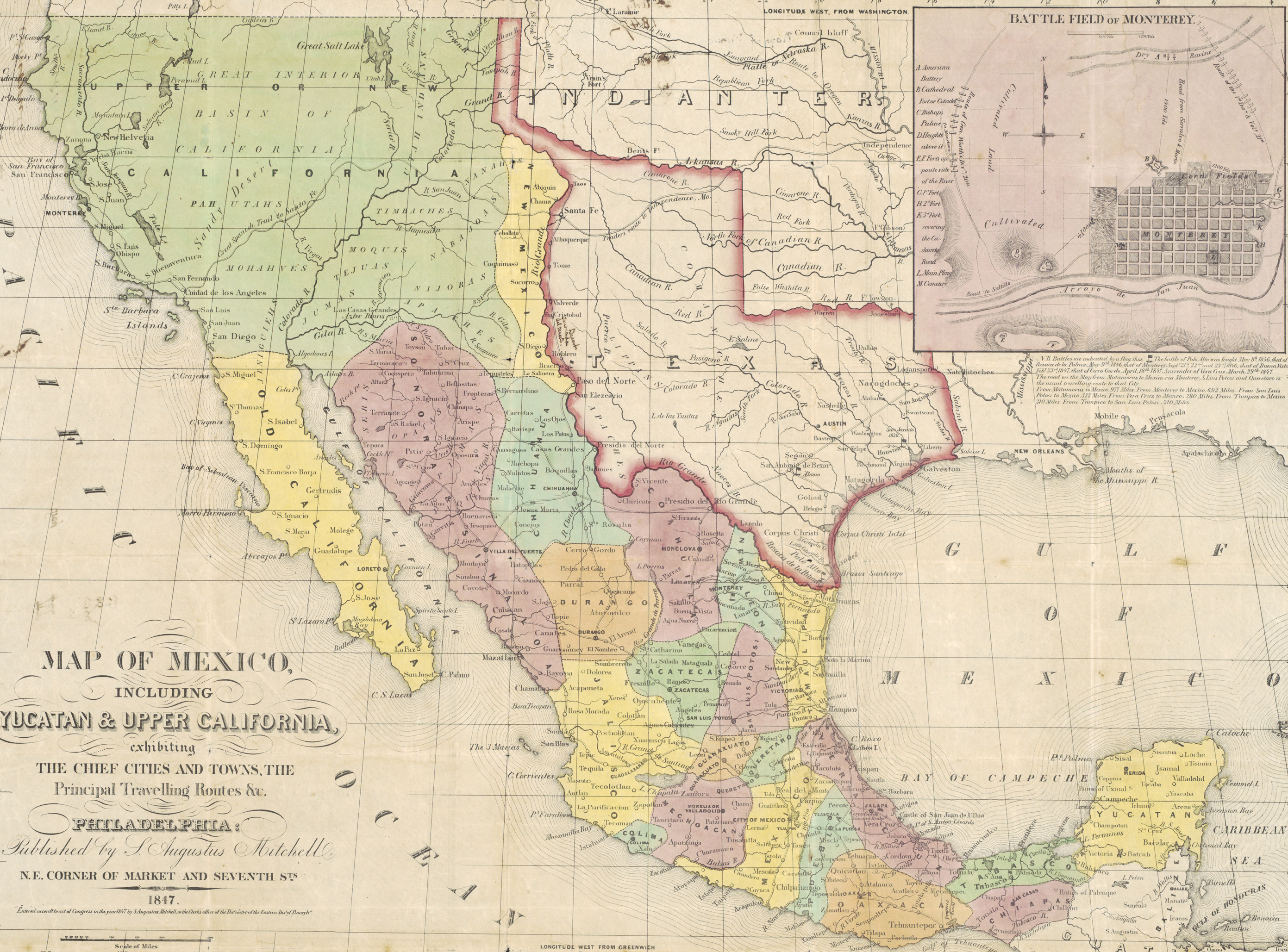 Mitchell & Stealey Map of Mexico 1847 UTA (Map of Mexico)
 Map of Mexico including Yucatan and Upper California 1847
 Map of Mexico inc Yucatan & Upper California Mitchell 1848
 Map of Yucatan 1848Map of Yucatan 1848
| Type | Subtype | Date | Description | Notes | Source |
|---|---|---|---|---|---|
| event | armed conflict | 1843 | Naval Battle of Campeche | Mexico, Republic of Texas, Republic of Yucatán, naval battle | Wikidata |
| event | war | 1847 | Caste War of Yucatán | war, Mexico, United Kingdom of Great Britain and Ireland, Republic of Yucatán, British Honduras, Chan Santa Cruz | Wikidata |
| commons | image | Mitchell Map of Mexico Including Yucatan & Upper California Exhibiting the Chief Cities and Towns 1847 UTA | Commons | ||
| commons | image | Mitchell & Stealey Map of Mexico 1847 UTA (Map of Mexico) | Commons | ||
| commons | image | Map of Mexico including Yucatan and Upper California 1847 | Commons | ||
| commons | image | Map of Mexico inc Yucatan & Upper California Mitchell 1848 | Commons | ||
| commons | image | Map of Yucatan 1848 | Commons | ||
| commons | image | Map of Yucatan 1848 | Commons | ||
.jpg)