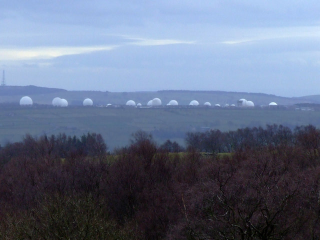
Loading map...
{"minzoom":false,"maxzoom":false,"mappingservice":"leaflet","width":"auto","height":"600px","centre":false,"title":"","label":"","icon":"","lines":[],"polygons":[],"circles":[],"rectangles":[],"copycoords":false,"static":false,"zoom":false,"defzoom":14,"layers":["OpenStreetMap","Esri.WorldImagery"],"image layers":[],"overlays":[],"resizable":false,"fullscreen":true,"scrollwheelzoom":true,"cluster":false,"clustermaxzoom":20,"clusterzoomonclick":true,"clustermaxradius":1,"clusterspiderfy":true,"geojson":"","clicktarget":"","imageLayers":[],"locations":[{"text":"\u003Cb\u003E\u003Cdiv class=\"mw-parser-output\"\u003E\u003Cp\u003ERAF Menwith Hill\u003C/b\u003E\u003Cdiv class=\"mw-parser-output\"\u003E\u003Cp\u003ERoyal Air Force station near Harrogate, North Yorkshire, United Kingdom\n\u003C/p\u003E\u003C/div\u003E","title":"RAF Menwith Hill@Royal Air Force station near Harrogate, North Yorkshire, United Kingdom\n","link":"","lat":54.008055555,"lon":-1.69,"icon":"/images/d/d2/Red-marker.png"},{"text":"\u003Cb\u003E\u003Cdiv class=\"mw-parser-output\"\u003E\u003Cp\u003E\u003Ca href=\"/Q17067727\" title=\"Q17067727\"\u003EAlanbrooke Barracks\u003C/a\u003E\u003C/b\u003E\u003Cdiv class=\"mw-parser-output\"\u003E\u003Cp\u003E1974 barracks\n\u003C/p\u003E\u003C/div\u003E","title":"Alanbrooke Barracks@1974 barracks\n","link":"","lat":54.2035,"lon":-1.40152,"icon":"/images/1/14/M_base.png"},{"text":"\u003Cb\u003E\u003Cdiv class=\"mw-parser-output\"\u003E\u003Cp\u003E\u003Ca href=\"/Q28404494\" title=\"Q28404494\"\u003EBradford Moor Barracks\u003C/a\u003E\u003C/b\u003E\u003Cdiv class=\"mw-parser-output\"\u003E\u003Cp\u003E1843 barracks\n\u003C/p\u003E\u003C/div\u003E","title":"Bradford Moor Barracks@1843 barracks\n","link":"","lat":53.7983,"lon":-1.71943,"icon":"/images/1/14/M_base.png"},{"text":"\u003Cb\u003E\u003Cdiv class=\"mw-parser-output\"\u003E\u003Cp\u003E\u003Ca href=\"/Q17514618\" title=\"Q17514618\"\u003ECarlton Barracks\u003C/a\u003E\u003C/b\u003E\u003Cdiv class=\"mw-parser-output\"\u003E\u003Cp\u003E1887 barracks\n\u003C/p\u003E\u003C/div\u003E","title":"Carlton Barracks@1887 barracks\n","link":"","lat":53.8059,"lon":-1.54602,"icon":"/images/1/14/M_base.png"},{"text":"\u003Cb\u003E\u003Cdiv class=\"mw-parser-output\"\u003E\u003Cp\u003E\u003Ca href=\"/Q386087\" title=\"Q386087\"\u003ECatterick Garrison\u003C/a\u003E\u003C/b\u003E\u003Cdiv class=\"mw-parser-output\"\u003E\u003Cp\u003EBritish Army, garrison, town\n\u003C/p\u003E\u003C/div\u003E","title":"Catterick Garrison@ British Army, garrison, town\n","link":"","lat":54.3775,"lon":-1.722,"icon":"/images/1/14/M_base.png"},{"text":"\u003Cb\u003E\u003Cdiv class=\"mw-parser-output\"\u003E\u003Cp\u003E\u003Ca href=\"/Q16827037\" title=\"Q16827037\"\u003EClaro Barracks\u003C/a\u003E\u003C/b\u003E\u003Cdiv class=\"mw-parser-output\"\u003E\u003Cp\u003E1914 barracks\n\u003C/p\u003E\u003C/div\u003E","title":"Claro Barracks@1914 barracks\n","link":"","lat":54.1435,"lon":-1.54996,"icon":"/images/1/14/M_base.png"},{"text":"\u003Cb\u003E\u003Cdiv class=\"mw-parser-output\"\u003E\u003Cp\u003E\u003Ca href=\"/Q5632467\" title=\"Q5632467\"\u003EHMS Forest Moor\u003C/a\u003E\u003C/b\u003E\u003Cdiv class=\"mw-parser-output\"\u003E\u003Cp\u003E1960 naval shore establishment, Royal Navy\n\u003C/p\u003E\u003C/div\u003E","title":"HMS Forest Moor@1960 naval shore establishment, Royal Navy\n","link":"","lat":54.0119,"lon":-1.72101,"icon":"/images/1/14/M_base.png"},{"text":"\u003Cb\u003E\u003Cdiv class=\"mw-parser-output\"\u003E\u003Cp\u003E\u003Ca href=\"/Q19972071\" title=\"Q19972071\"\u003ERichmond Barracks, North Yorkshire\u003C/a\u003E\u003C/b\u003E\u003Cdiv class=\"mw-parser-output\"\u003E\u003Cp\u003E1875 military base\n\u003C/p\u003E\u003C/div\u003E","title":"Richmond Barracks, North Yorkshire@1875 military base\n","link":"","lat":54.4111,"lon":-1.73224,"icon":"/images/1/14/M_base.png"},{"text":"\u003Cb\u003E\u003Cdiv class=\"mw-parser-output\"\u003E\u003Cp\u003E\u003Ca href=\"/Q19972075\" title=\"Q19972075\"\u003EWellesley Barracks\u003C/a\u003E\u003C/b\u003E\u003Cdiv class=\"mw-parser-output\"\u003E\u003Cp\u003E1881 building complex, barracks\n\u003C/p\u003E\u003C/div\u003E","title":"Wellesley Barracks@1881 building complex, barracks\n","link":"","lat":53.7231,"lon":-1.89351,"icon":"/images/1/14/M_base.png"},{"text":"\u003Cb\u003E\u003Cdiv class=\"mw-parser-output\"\u003E\u003Cp\u003E\u003Ca href=\"/Q50413598\" title=\"Q50413598\"\u003EDuke of Wellington's Regiment Museum\u003C/a\u003E\u003C/b\u003E\u003Cdiv class=\"mw-parser-output\"\u003E\u003Cp\u003Eregimental museum, independent museum, \u003Ca rel=\"nofollow\" class=\"external text\" href=\"https://www.tripadvisor.com/18919763\"\u003Etripadvisor\u003C/a\u003E\n\u003C/p\u003E\u003C/div\u003E","title":"Duke of Wellington's Regiment Museum@ regimental museum, independent museum, tripadvisor\n","link":"","lat":53.725,"lon":-1.8629,"icon":"/images/f/f6/Tm_museum.png"},{"text":"\u003Cb\u003E\u003Cdiv class=\"mw-parser-output\"\u003E\u003Cp\u003E\u003Ca href=\"/Q5602684\" title=\"Q5602684\"\u003EGreen Howards Museum\u003C/a\u003E\u003C/b\u003E\u003Cdiv class=\"mw-parser-output\"\u003E\u003Cp\u003E1938 independent museum, regimental museum, church building, \u003Ca rel=\"nofollow\" class=\"external text\" href=\"https://www.tripadvisor.com/3687012\"\u003Etripadvisor\u003C/a\u003E\n\u003C/p\u003E\u003C/div\u003E","title":"Green Howards Museum@1938 independent museum, regimental museum, church building, tripadvisor\n","link":"","lat":54.4028,"lon":-1.73719,"icon":"/images/f/f6/Tm_museum.png"},{"text":"\u003Cb\u003E\u003Cdiv class=\"mw-parser-output\"\u003E\u003Cp\u003E\u003Ca href=\"/Q7373689\" title=\"Q7373689\"\u003ERoyal Armouries Leeds\u003C/a\u003E\u003C/b\u003E\u003Cdiv class=\"mw-parser-output\"\u003E\u003Cp\u003E1996 national museum, military museum, \u003Ca rel=\"nofollow\" class=\"external text\" href=\"https://www.tripadvisor.com/189274\"\u003Etripadvisor\u003C/a\u003E\n\u003C/p\u003E\u003C/div\u003E","title":"Royal Armouries Leeds@1996 national museum, military museum, tripadvisor\n","link":"","lat":53.7919,"lon":-1.53204,"icon":"/images/f/f6/Tm_museum.png"},{"text":"\u003Cb\u003E\u003Cdiv class=\"mw-parser-output\"\u003E\u003Cp\u003E\u003Ca href=\"/Q7762977\" title=\"Q7762977\"\u003EThe Second World War Experience Centre\u003C/a\u003E\u003C/b\u003E\u003Cdiv class=\"mw-parser-output\"\u003E\u003Cp\u003E1998 military museum\n\u003C/p\u003E\u003C/div\u003E","title":"The Second World War Experience Centre@1998 military museum\n","link":"","lat":53.9167,"lon":-1.31368,"icon":"/images/7/75/M_museum.png"}],"imageoverlays":null}


