The Seventeen Provinces was a term used to describe the Spanish Netherlands before the Dutch Revolt, when they were at their largest extent. They covered most of the Low Countries, i.e., what is now the Netherlands, Belgium, Luxembourg, and most of the French departments of Nord and Pas-de-Calais (Artois).
Blaeu 1645 - Novus XVII Inferioris Germaniæ Provinciarum typus
Descriptio Germaniae Inferioris Nederlanden Map by Abraham Ortelius 1573
Belgii Universi seu Inferioris Germaniae (Dix-Sept Provinces, Zeventien Provincien, Seventeen Provinces) Map
The BL King’s Topographical Collection- "NIEUWE KAART van de XVII NEDERLANDSCHE PROVINCIEN "
Allegorie op de tirannie van de hertog van Alva in de Nederlanden Rijksmuseum SK-C-1551
Allegorie Pacificatie van Gent
Descriptio Germaniae Inferioris Nederlanden Map by Abraham Ortelius 1573
Kaart van de Zeventien Provinciën Belgii Universi seu Inferioris Germaniae quam XVII Provinciae … Carte des XVII Provinces ou de l’Allemagne Inferieure … (titel op object), RP-P-AO-1-109
Atlas Ortelius KB PPN369376781-026av-026br
Leo Belgicus (1611), by Visscher, an emblematic map of Belgium
civil war, Spanish Empire, Kingdom of France, Dutch Republic, Kingdom of England, Kingdom of Scotland, Union of Utrecht, Seventeen Provinces, Watergeuzen, Geuzen, Union of Arras, Iberian Union, revolt, County of Nassau, Principality of Nassau-Diez

 Blaeu 1645 - Novus XVII Inferioris Germaniæ Provinciarum typus
 Descriptio Germaniae Inferioris Nederlanden Map by Abraham Ortelius 1573
 Belgii Universi seu Inferioris Germaniae (Dix-Sept Provinces, Zeventien Provincien, Seventeen Provinces) Map
 The BL King’s Topographical Collection- "NIEUWE KAART van de XVII NEDERLANDSCHE PROVINCIEN "
 Allegorie op de tirannie van de hertog van Alva in de Nederlanden Rijksmuseum SK-C-1551
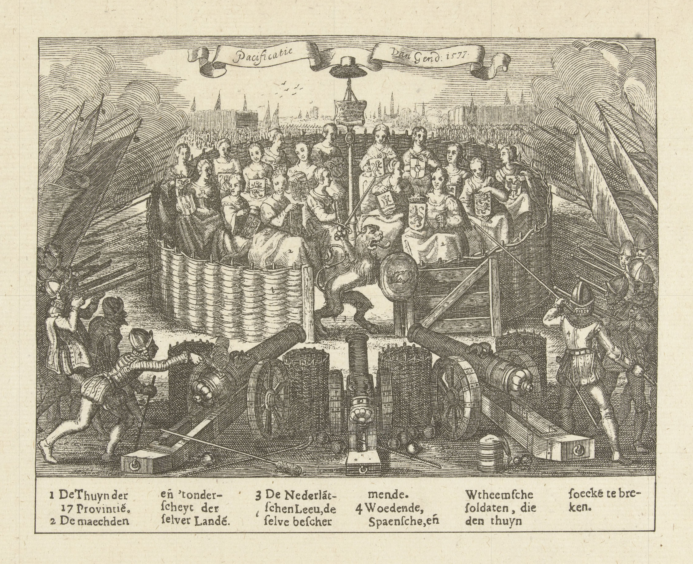 Allegorie Pacificatie van Gent
 Kaart van de Zeventien Provinciën Belgii Universi seu Inferioris Germaniae quam XVII Provinciae … Carte des XVII Provinces ou de l’Allemagne Inferieure … (titel op object), RP-P-AO-1-109
 Atlas Ortelius KB PPN369376781-026av-026br
 Leo Belgicus (1611), by Visscher, an emblematic map of Belgium
_Map.jpg)
,_RP-P-AO-1-109.jpg)