Invasion of Guadeloupe
From Warlike
Q3153837
The British expedition against Guadeloupe was a military action from January to May 1759, as part of the Seven Years' War. A large British force had arrived in the West Indies, intending to seize French possessions. After a six-month-long battle to capture Guadeloupe they finally received the formal surrender of the island, just days before a large French relief force arrived under Admiral Maximin de Bompart.
1759
Wikimedia, Wikidata
Kingdom of Great Britain, France, 
-
Location: 16, -61.7333, KML, Cluster Map, Maps,
6 places
-

ⓘ
1759-01-22T00:00:00Z
1759-05-01T00:00:00Z
1759 Invasion of Guadeloupe
1782-04-09T00:00:00Z
1782-04-12T00:00:00Z
1809-01-22T00:00:00Z
1809-01-22T00:00:00Z
{"selectable":false,"showCurrentTime":false,"width":"100%","zoomMin":100000000000}
 A South West View of Fort Royal in the Island of Guadaloupe RMG PX8832
 Basseterre, 1759 RCIN 732091
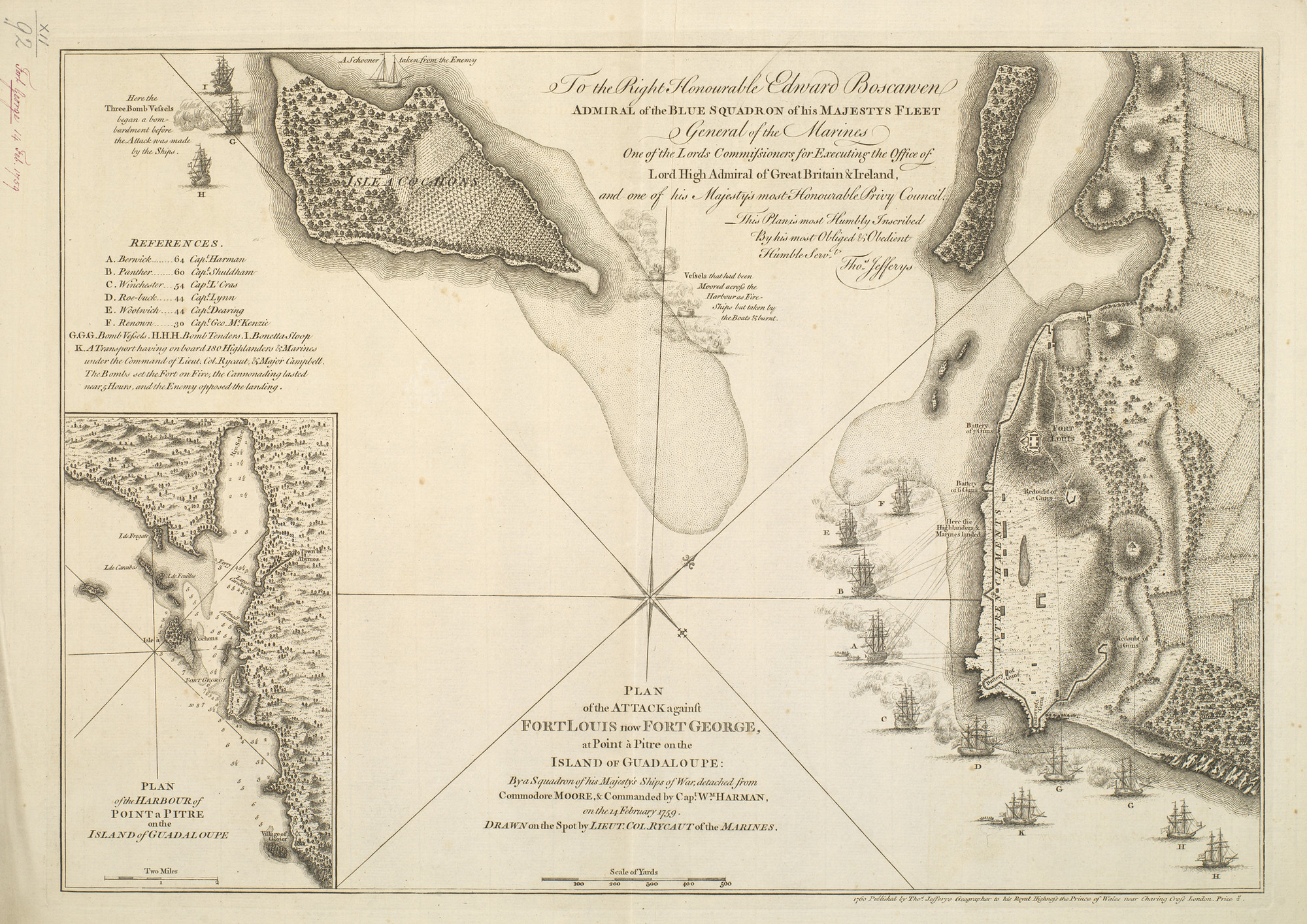 Pointe-à-Pitre, 1759 RCIN 732092
 A South West View of Fort Royal in the Island of Guadaloupe
 A north view of Fort Royal in the island of Guadaloupe, when in Possession of his majestys forces in 1759 LCCN2003688821
 A North View of Fort Royal in the Island of Guadaloupe, When in Posession of His Majesty's Forces in 1759
 An East View of Fort Royal in the Island of Guadaloupe
 A new and accurate map of the isles of Guadaloupe, Marie-Galante etc. from the best authorities LOC 2010593358
 Guadalupe with the adjacent islands. LOC 2010593356
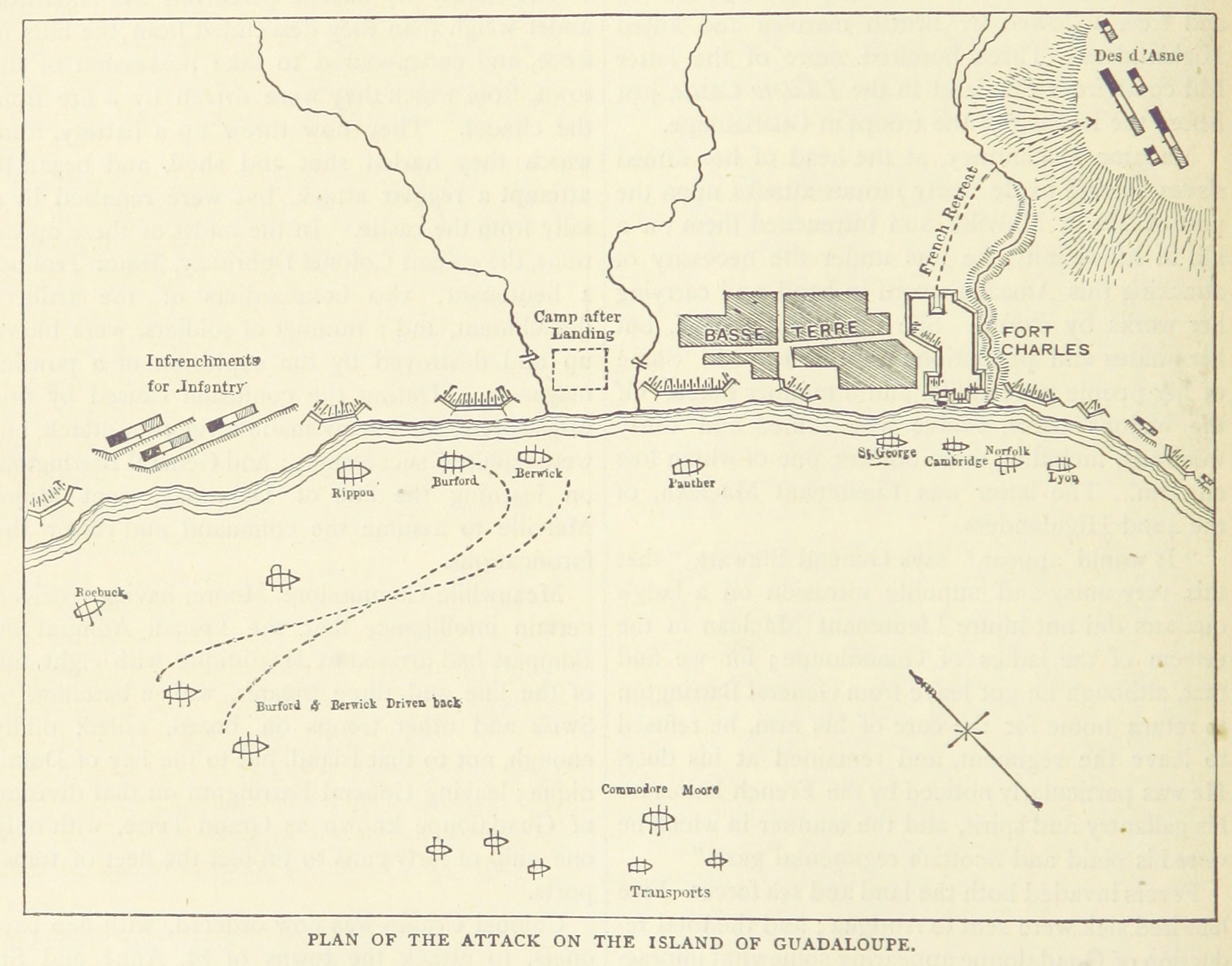 Invasion of Guadeloupe (1759)
.jpg)