The term Kingdom of Sardinia denotes the Savoyard state from 1720 to 1861. From 1720 to 1847, only the island of Sardinia proper was part of the Kingdom of Sardinia, while the other mainland possessions were held by the House of Savoy in their own right, hence forming a composite monarchy and a personal union, which was formally referred to as the "States of His Majesty the King of Sardinia". This situation was changed by the Perfect Fusion act of 1847, which created a unitary kingdom. Regardless, historians often use "Sardinia" as a synecdoche to designate the whole Savoyard state from 1720. Due to the fact that Piedmont was the seat of power and prominent part of the entity, the state is also referred to as Sardinia–Piedmont or Piedmont–Sardinia, and sometimes erroneously as the Kingdom of Piedmont.
Restitution de la Savoie au royaume de Sardaigne, 20 novembre 1815, ND4210 (1 of 2)
Restitution de la Savoie au royaume de Sardaigne, 20 novembre 1815, ND4210 (2 of 2)
Il Regno di Sardegna nel 1860
Union framework of the Charter of States of His Majesty Sarda on the mainland
Mineralogical map of the States of Savoy (Kingdom of Sardinia) by Robilant published in his 1786 "Essai géographique". The numbers correspond with a lable of mineral occurences in the essay.
Mineralogical map of the States of Savoy (Kingdom of Sardinia) by Robilant published in his 1786 "Essai géographique". The numbers correspond with a lable of mineral occurences in the essay.
Western Europe Utrecht Treaty
SardiniePiemont
Northern Italian Peninsula circa 1796 CE (including the Kingdom of Sardinia, the Duchies of Mantua, Milan, Modena and Parma, and the Republics of Genoa, Lucca and Venice)
Colonel's flag of the Provincial Regiment of Asti, Kingdom of Sardinia (1814), embroidered gold and silk, Museo del Risorgimento (Milan).

 Restitution de la Savoie au royaume de Sardaigne, 20 novembre 1815, ND4210 (1 of 2)
 Restitution de la Savoie au royaume de Sardaigne, 20 novembre 1815, ND4210 (2 of 2)
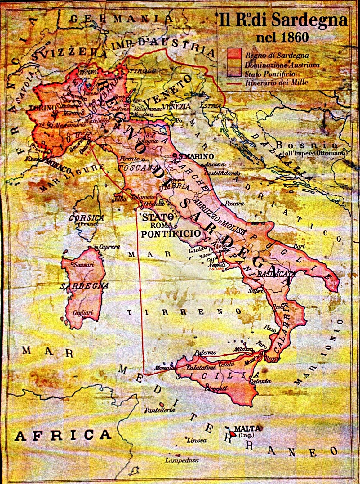 Il Regno di Sardegna nel 1860
 Union framework of the Charter of States of His Majesty Sarda on the mainland
 Mineralogical map of the States of Savoy (Kingdom of Sardinia) by Robilant published in his 1786 "Essai géographique". The numbers correspond with a lable of mineral occurences in the essay.
 Mineralogical map of the States of Savoy (Kingdom of Sardinia) by Robilant published in his 1786 "Essai géographique". The numbers correspond with a lable of mineral occurences in the essay.
 Western Europe Utrecht Treaty
 SardiniePiemont
 Northern Italian Peninsula circa 1796 CE (including the Kingdom of Sardinia, the Duchies of Mantua, Milan, Modena and Parma, and the Republics of Genoa, Lucca and Venice)
 Colonel's flag of the Provincial Regiment of Asti, Kingdom of Sardinia (1814), embroidered gold and silk, Museo del Risorgimento (Milan).
.jpg)
.jpg)
.jpg)