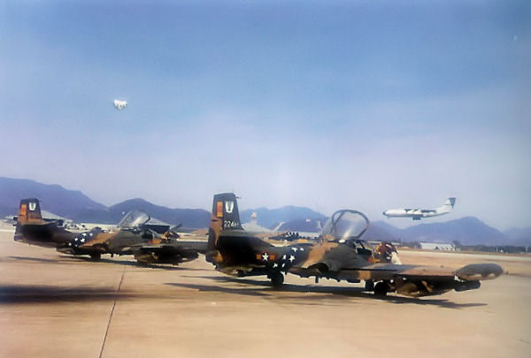
Da Nang Air Base
From Warlike
Q1656800
military base
Wikimedia, Wikidata
— [[Error: Invalid time.]]
airbase, World War II, Da Nang International Airport, Vietnam, 
Location: 16.043888888, 108.199444444, ///yarn.patting.dorms, Google, Bing, Aerial View, OldMapsOnline, ESRI Imagery, Historic Markers, KML
- All fortification sites
- All maritime sites
- All subterranean sites
- All weapon sites
- All military sites
| Type | Description | Date | Keywords | Notes | Source |
|---|---|---|---|---|---|
| link | Google Knowledge entry@ | Wikidata | |||
| base | An Hoa Combat Base | 1966 | military base | Wikidata | |
| base | Camp Horn | 1966 | military base | Wikidata | |
| base | Hill 100 | firebase, hill | Wikidata | ||
| image | A portion of the Marine Compound at Da Nang | Wikimedia | |||
| image | A-37B VNAF 516FS DaNang | 2006 | Wikimedia | ||
| image | Danang Air Field (17088942195) | 2010 | Wikimedia | ||
| image | Danang Air Field (17088958885) | 2010 | Wikimedia | ||
| image | Da Nang Air Base during the Vietnam War | Wikimedia | |||
| image | EF-10B VMCJ-1 DaNang | Wikimedia | |||
| image | F-4C of the 389th Tactical Fighter Squadron at DaNang | Wikimedia | |||


