Woolston Shipyard - geograph.org.uk - 22542.jpg
From Warlike
No higher resolution available.
Woolston_Shipyard_-_geograph.org.uk_-_22542.jpg (640 × 427 pixels, file size: 77 KB, MIME type: image/jpeg)
Summary
| Description |
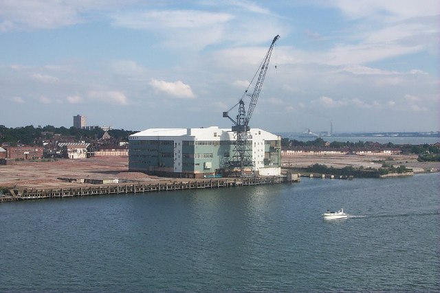
English: Woolston Shipyard. Most of the shipyard is now gone. Ships had been built there for over a hundred years. All soon to be houses and flats. St Mark's Church can be seen just behind and in the distance the flats at Weston. If you look very carefully you will see the Queen Elizabeth 2 sailing down river |
| Date | |
| Source | From geograph.org.uk |
| Author | David Mainwood |
| Attribution (required by the licence) | David Mainwood / Woolston Shipyard / |
| Camera location | | View this and other nearby images on: OpenStreetMap |
|---|
_heading:157.00&language=en-gb)
| Object location | | View this and other nearby images on: OpenStreetMap |
|---|
_heading:157.00&language=en-gb)
Licensing

|
This image was taken from the Geograph GB & Eire project collection. See this photograph's page on the Geograph website for the photographer's contact details. The copyright on this image is owned by David Mainwood, and is licensed for reuse under the Creative Commons Attribution Share-Alike 2.0 license.
|
This file is licensed under the Creative Commons Attribution-Share Alike 2.0 Generic licence.
Attribution:
David Mainwood
- You are free:
- to share – to copy, distribute and transmit the work
- to remix – to adapt the work
- Under the following conditions:
- attribution – You must give appropriate credit, provide a link to the licence, and indicate if changes were made. You may do so in any reasonable manner, but not in any way that suggests the licensor endorses you or your use.
- share alike – If you remix, transform, or build upon the material, you must distribute your contributions under the same or compatible licence as the original.
File history
Click on a date/time to view the file as it appeared at that time.
| Date/Time | Thumbnail | Dimensions | User | Comment | |
|---|---|---|---|---|---|
| current | 05:55, 30 January 2010 | | 640 × 427 (77 KB) | wikimediacommons>GeographBot | == {{int:filedesc}} == {{Information |description={{en|1=Woolston Shipyard. Most of the shipyard is now gone. Ships had been built there for over a hundred years. All soon to be houses and flats. St Mark's Church can be seen just behind and in the distanc |
File usage
There are no pages that use this file.