Visby ringmur - KMB - 16000300029438.jpg
From Warlike

Size of this preview: 499 × 599 pixels. Other resolutions: 200 × 240 pixels | 512 × 615 pixels.
Original file (512 × 615 pixels, file size: 106 KB, MIME type: image/jpeg)
| Visby ringmur
( |
|||||||||||||||||||||||||||
|---|---|---|---|---|---|---|---|---|---|---|---|---|---|---|---|---|---|---|---|---|---|---|---|---|---|---|---|
| Photographer |
|
||||||||||||||||||||||||||
| Title |
Visby ringmur |
||||||||||||||||||||||||||
| Original caption |
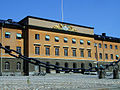
Notera Av dokumentationsskäl har originalbeskrivningen från Riksantikvarieämbetet behållits. Tillrättalägganden och alternativa beskrivningar bör införas separat från nedanstående information. Norderport. Jämför med bild ND37931 från 2009.Felaktigheter kan även anmälas till denna sida. Motiv: Visby ringmur |
||||||||||||||||||||||||||
| Description |
Norderport. Jämför med bild ND37931 från 2009.
|
||||||||||||||||||||||||||
| Depicted place | Sweden, Region Gotland, Visby civil parish | ||||||||||||||||||||||||||
| Date | Unknown date | ||||||||||||||||||||||||||
| Collection |
|
||||||||||||||||||||||||||
| Accession number | |||||||||||||||||||||||||||
| Source |
Carl Curman / Kulturmiljöbild, Riksantikvarieämbetet
|
||||||||||||||||||||||||||
| Permission (Reusing this file) |
|
||||||||||||||||||||||||||
.jpg)


| Object location | | View this and other nearby images on: OpenStreetMap |
|---|
File history
Click on a date/time to view the file as it appeared at that time.
| Date/Time | Thumbnail | Dimensions | User | Comment | |
|---|---|---|---|---|---|
| current | 21:59, 9 June 2017 | | 512 × 615 (106 KB) | wikimediacommons>AndreCostaWMSE-bot | {{Kulturmiljöbild-image | short title = Visby ringmur | original description = Norderport. Jämför med bild ND37931 från 2009.<br> Motiv: Visby ringmur<br> Nyckelord: Raä-Fastigheter, Riksintressen, Världsarv<br> Kategori: Stadsvall/stadsmur | wik... |
File usage
There are no pages that use this file.