Tracian state.png
From Warlike
File:Tracian state.png

Size of this preview: 561 × 599 pixels. Other resolutions: 225 × 240 pixels | 449 × 480 pixels | 719 × 768 pixels | 958 × 1,024 pixels | 1,386 × 1,481 pixels.
Original file (1,386 × 1,481 pixels, file size: 926 KB, MIME type: image/png)
Summary
| Description |
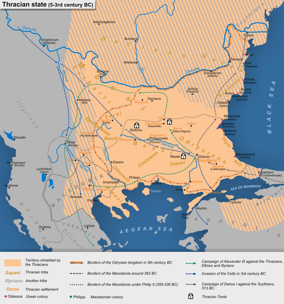
English: Tracian state (5-3rd century BC)
Български: Тракийска държава (5-3 век пр.н.е.)
Based on map "Thracian state (V-III century BC)" in the atlas "Atlas of the history of the Old World," Integrated Research Institute and Design Mapping, Sofia, 1979 (Основана на картата "Тракийска държава (V-III век пр.н.е.)" в "Атлас по история на Стария свят", Комплексен институт за проучване и проектиране по картография, София, 1979 г.) |
| Date | |
| Source | Own work |
| Author | Kandi |
Licensing
I, the copyright holder of this work, hereby publish it under the following licences:

|
Permission is granted to copy, distribute and/or modify this document under the terms of the GNU Free Documentation Licence, Version 1.2 or any later version published by the Free Software Foundation; with no Invariant Sections, no Front-Cover Texts, and no Back-Cover Texts. A copy of the licence is included in the section entitled GNU Free Documentation Licence. |
This file is licensed under the Creative Commons Attribution-Share Alike 4.0 International, 3.0 Unported, 2.5 Generic, 2.0 Generic and 1.0 Generic license.
- You are free:
- to share – to copy, distribute and transmit the work
- to remix – to adapt the work
- Under the following conditions:
- attribution – You must give appropriate credit, provide a link to the licence, and indicate if changes were made. You may do so in any reasonable manner, but not in any way that suggests the licensor endorses you or your use.
- share alike – If you remix, transform, or build upon the material, you must distribute your contributions under the same or compatible licence as the original.
You may select the licence of your choice.
File history
Click on a date/time to view the file as it appeared at that time.
| Date/Time | Thumbnail | Dimensions | User | Comment | |
|---|---|---|---|---|---|
| current | 09:10, 26 December 2020 | | 1,386 × 1,481 (926 KB) | wikimediacommons>Kandi | Reverted to version as of 10:21, 7 October 2013 (UTC) |
File usage
The following page uses this file: