Third Ypres - Map Showing Progress in the Ypres Area..jpg
From Warlike
File:Third Ypres - Map Showing Progress in the Ypres Area..jpg
Size of this preview: 349 × 598 pixels. Other resolutions: 140 × 240 pixels | 280 × 480 pixels | 448 × 768 pixels | 597 × 1,024 pixels | 1,194 × 2,048 pixels | 2,566 × 4,400 pixels.
Original file (2,566 × 4,400 pixels, file size: 4.63 MB, MIME type: image/jpeg)
Summary
| Title |
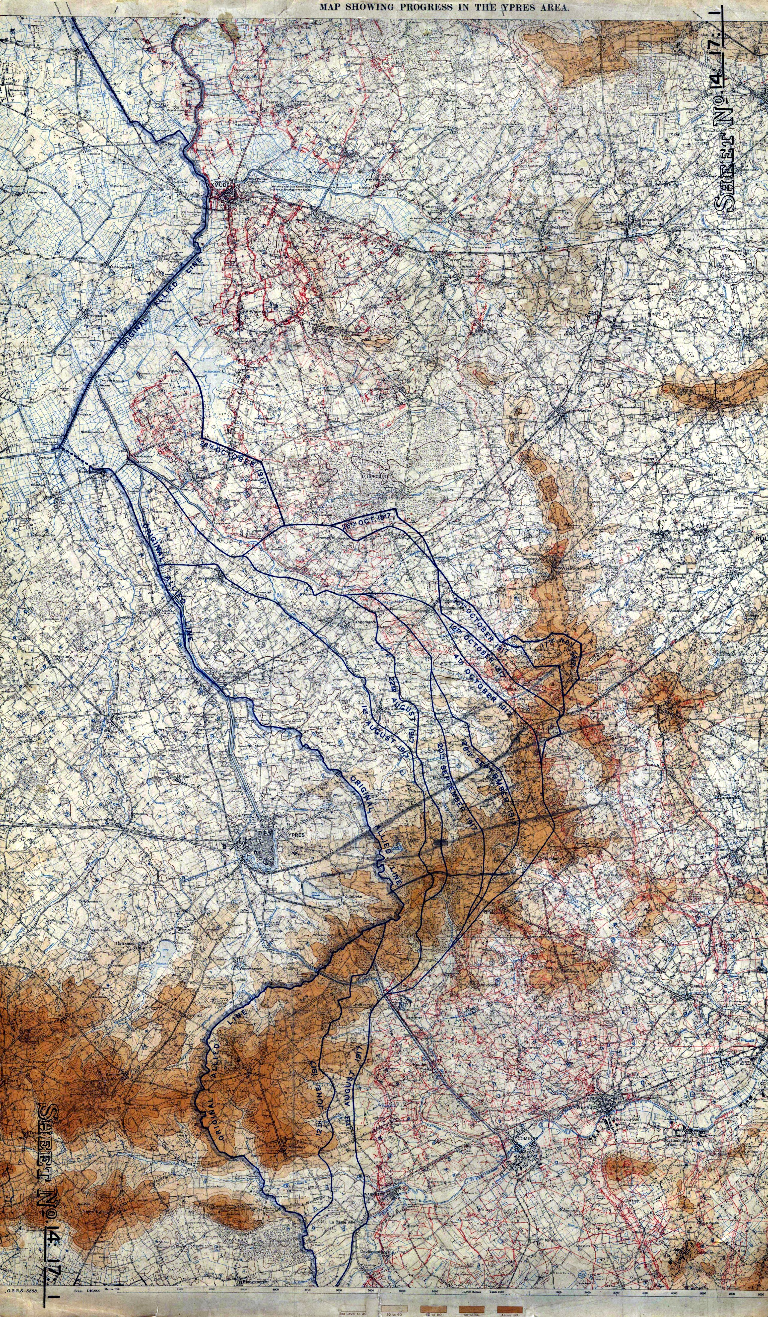
English: Map Showing Progress in the Ypres Area |
|||||||||||||||||||||||
| Description |
English: Map showing progress in the Ypres area, 1 Aug to 17 Nov, 1917. 8th edition. GSGS 3588. 1:40,000. War Office. |
|||||||||||||||||||||||
| Date | ||||||||||||||||||||||||
| Source |
The National Archives, Kew (FO 925/24005) http://blog.awm.gov.au/awm/wp-content/uploads/maps/Ypres_Offensive.pdf |
|||||||||||||||||||||||
| Creator |
War Office. General Staff. Geographical Section, Field Service Battalion, Royal Engineers |
|||||||||||||||||||||||
| Permission (Reusing this file) |
|
|||||||||||||||||||||||
| Geotemporal data | ||||||||||||||||||||||||
| Date depicted | ||||||||||||||||||||||||
| Map location | Ieper | |||||||||||||||||||||||
| Map type | trench map | |||||||||||||||||||||||
| Scale | 1:40000 | |||||||||||||||||||||||
| Heading |
 |
|||||||||||||||||||||||
| Bounding box |
|
|||||||||||||||||||||||
| Georeferencing | ||||||||||||||||||||||||
| Bibliographic data | ||||||||||||||||||||||||
| Map sheet | 14:17:1 | |||||||||||||||||||||||
| Language | English | |||||||||||||||||||||||
| Publisher |
Royal Engineers |
|||||||||||||||||||||||
| Archival data | ||||||||||||||||||||||||
| Collection |
|
|||||||||||||||||||||||

File history
Click on a date/time to view the file as it appeared at that time.
| Date/Time | Thumbnail | Dimensions | User | Comment | |
|---|---|---|---|---|---|
| current | 19:44, 10 February 2009 | | 2,566 × 4,400 (4.63 MB) | wikimediacommons>Labattblueboy | {{Information |Description=Map showing progress in the Ypres area, 1 Aug to 17 Nov, 1917. 8th edition. GSGS 3588. 1:40,000. War Office. |Source= The National Archives, Kew (FO 925/24005)<br>http://blog.awm.gov.au/awm/wp-content/uploads/maps/Ypres_Offensiv |
File usage
The following page uses this file: