Sutlema mõisa väravatorn 02-08-2012.jpg
From Warlike
Size of this preview: 795 × 599 pixels. Other resolutions: 319 × 240 pixels | 637 × 480 pixels | 1,019 × 768 pixels | 1,280 × 965 pixels | 2,560 × 1,930 pixels | 3,648 × 2,750 pixels.
Original file (3,648 × 2,750 pixels, file size: 8.51 MB, MIME type: image/jpeg)
Summary
| Description |
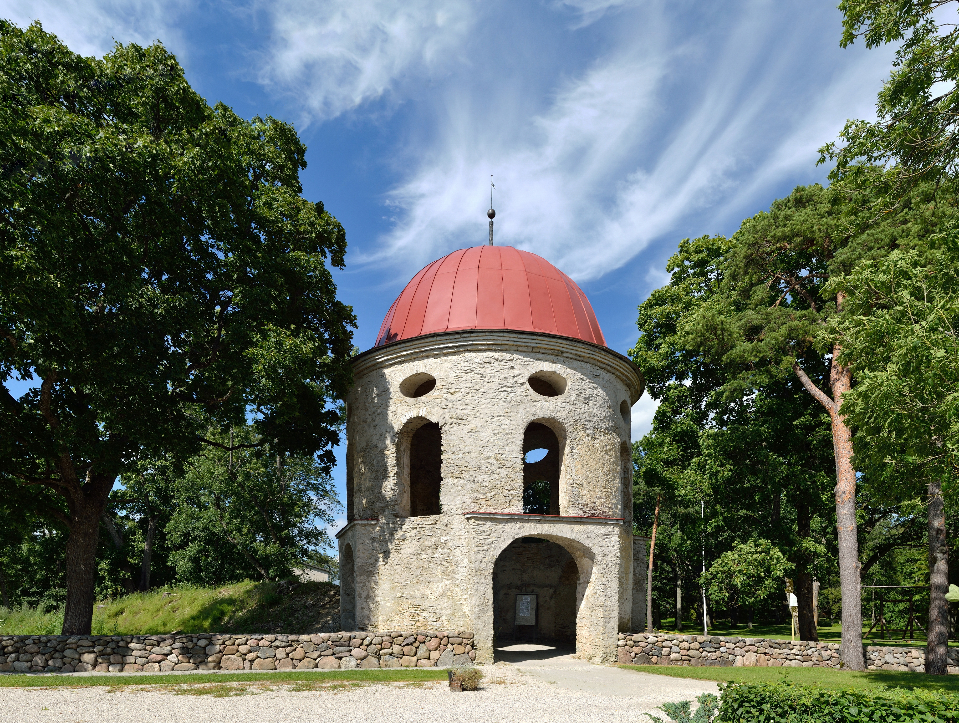
Eesti: Sutlema mõisa väravatorn, ehitatud 18. sajandi teises pooles
English: Sutlema manor gatetower, built in the second half of the 18. century
Русский: Воротная башня усадьбы Сутлема, построена во второй половине 18 века
|
||
| Date | |||
| Source | Own work | ||
| Author | Ivar Leidus |
| Camera location | | View this and other nearby images on: OpenStreetMap |
|---|
| Camera Model | Nikon D3100 |
|---|---|
| Shutter speed | 1/125; |
| Aperture | f/5.6; |
| Film speed (ISO) | 100; |

|
NOTE: This image is a panorama consisting of multiple frames that were merged in software. As a result, this image necessarily underwent some form of digital manipulation. These manipulations may include blending, blurring, cloning, and colour and perspective adjustments. As a result of these adjustments, the image content may be slightly different than reality at the points where multiple images were combined. This manipulation is often required due to lens, perspective, and parallax distortions.
|

|
This image was uploaded as part of Wiki Loves Monuments 2012.
|
Licensing
I, the copyright holder of this work, hereby publish it under the following licence:
This file is licensed under the Creative Commons Attribution-ShareAlike 3.0 Estonia licence.
- You are free:
- to share – to copy, distribute and transmit the work
- to remix – to adapt the work
- Under the following conditions:
- attribution – You must give appropriate credit, provide a link to the licence, and indicate if changes were made. You may do so in any reasonable manner, but not in any way that suggests the licensor endorses you or your use.
- share alike – If you remix, transform, or build upon the material, you must distribute your contributions under the same or compatible licence as the original.

Assessment
|

|
This image was nominated as a finalist in Wiki Loves Monuments 2012, the world's largest photo contest! |
File history
Click on a date/time to view the file as it appeared at that time.
| Date/Time | Thumbnail | Dimensions | User | Comment | |
|---|---|---|---|---|---|
| current | 16:37, 13 September 2012 | | 3,648 × 2,750 (8.51 MB) | wikimediacommons>Iifar | User created page with UploadWizard |
File usage
There are no pages that use this file.