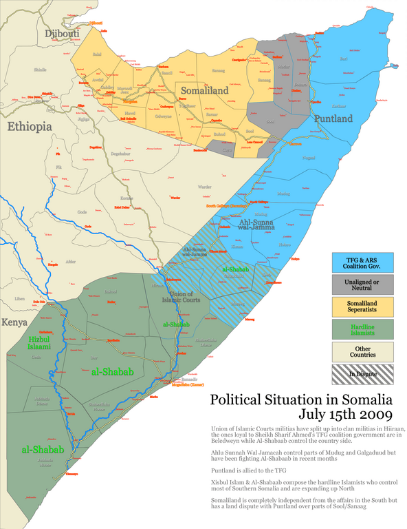
Somalia states regions districtsJuly1520091.png
From Warlike

Size of this preview: 462 × 599 pixels. Other resolutions: 185 × 240 pixels | 370 × 480 pixels | 592 × 768 pixels | 789 × 1,024 pixels | 2,138 × 2,773 pixels.
Original file (2,138 × 2,773 pixels, file size: 1.1 MB, MIME type: image/png)
Summary
| Description |
English: MY WORK |
| Date | |
| Source | Own work |
| Author | FAH1223 |
| Other versions | INGOMAN |
Licensing
| I, the copyright holder of this work, release this work into the public domain. This applies worldwide. In some countries this may not be legally possible; if so: I grant anyone the right to use this work for any purpose, without any conditions, unless such conditions are required by law. |
File history
Click on a date/time to view the file as it appeared at that time.
| Date/Time | Thumbnail | Dimensions | User | Comment | |
|---|---|---|---|---|---|
| current | 13:21, 7 November 2024 | | 2,138 × 2,773 (1.1 MB) | wikimediacommons>BorysMapping | Reverted. As per name, this map is supposed to be snapshot of of moment in 2009, not updated map |
File usage
The following 3 pages use this file: