Skipsea Castle - geograph.org.uk - 79788.jpg
From Warlike
No higher resolution available.
Skipsea_Castle_-_geograph.org.uk_-_79788.jpg (640 × 480 pixels, file size: 115 KB, MIME type: image/jpeg)
Summary
| Description |
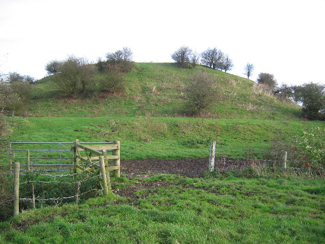
English: Skipsea Castle, Skipsea Brough, East Riding of Yorkshire, England. This view looking NE from the bottom SW corner of the grid square at TA1614455008. This is a fine example of a Motte and Bailey Castle |
| Date | |
| Source | From geograph.org.uk |
| Author | Stephen Horncastle |
| Permission (Reusing this file) |
Creative Commons Attribution Share-alike license 2.0 |
| Attribution (required by the licence) | Stephen Horncastle / Skipsea Castle / |
| Camera location | | View this and other nearby images on: OpenStreetMap |
|---|
_&language=en-gb)
| Object location | | View this and other nearby images on: OpenStreetMap |
|---|
_&language=en-gb)
Licensing

|
This image was taken from the Geograph GB & Eire project collection. See this photograph's page on the Geograph website for the photographer's contact details. The copyright on this image is owned by Stephen Horncastle, and is licensed for reuse under the Creative Commons Attribution Share-Alike 2.0 license.
|
This file is licensed under the Creative Commons Attribution-Share Alike 2.0 Generic licence.
Attribution:
Stephen Horncastle
- You are free:
- to share – to copy, distribute and transmit the work
- to remix – to adapt the work
- Under the following conditions:
- attribution – You must give appropriate credit, provide a link to the licence, and indicate if changes were made. You may do so in any reasonable manner, but not in any way that suggests the licensor endorses you or your use.
- share alike – If you remix, transform, or build upon the material, you must distribute your contributions under the same or compatible licence as the original.
File history
Click on a date/time to view the file as it appeared at that time.
| Date/Time | Thumbnail | Dimensions | User | Comment | |
|---|---|---|---|---|---|
| current | 19:06, 30 January 2010 | | 640 × 480 (115 KB) | wikimediacommons>GeographBot | == {{int:filedesc}} == {{Information |description={{en|1=Skipsea Castle. This view looking NE from the bottom SW corner of the grid square at TA1614455008. This is a fine example of a Motte and Bailey Castle}} |date=2005-11-05 |source=From [http://www.geo |
File usage
There are no pages that use this file.