Siege of Ciudad Rodrigo (1812) map.jpg
From Warlike
Size of this preview: 439 × 599 pixels. Other resolutions: 176 × 240 pixels | 352 × 480 pixels | 563 × 768 pixels | 750 × 1,024 pixels | 1,661 × 2,266 pixels.
Original file (1,661 × 2,266 pixels, file size: 596 KB, MIME type: image/jpeg)
Summary
| Description |
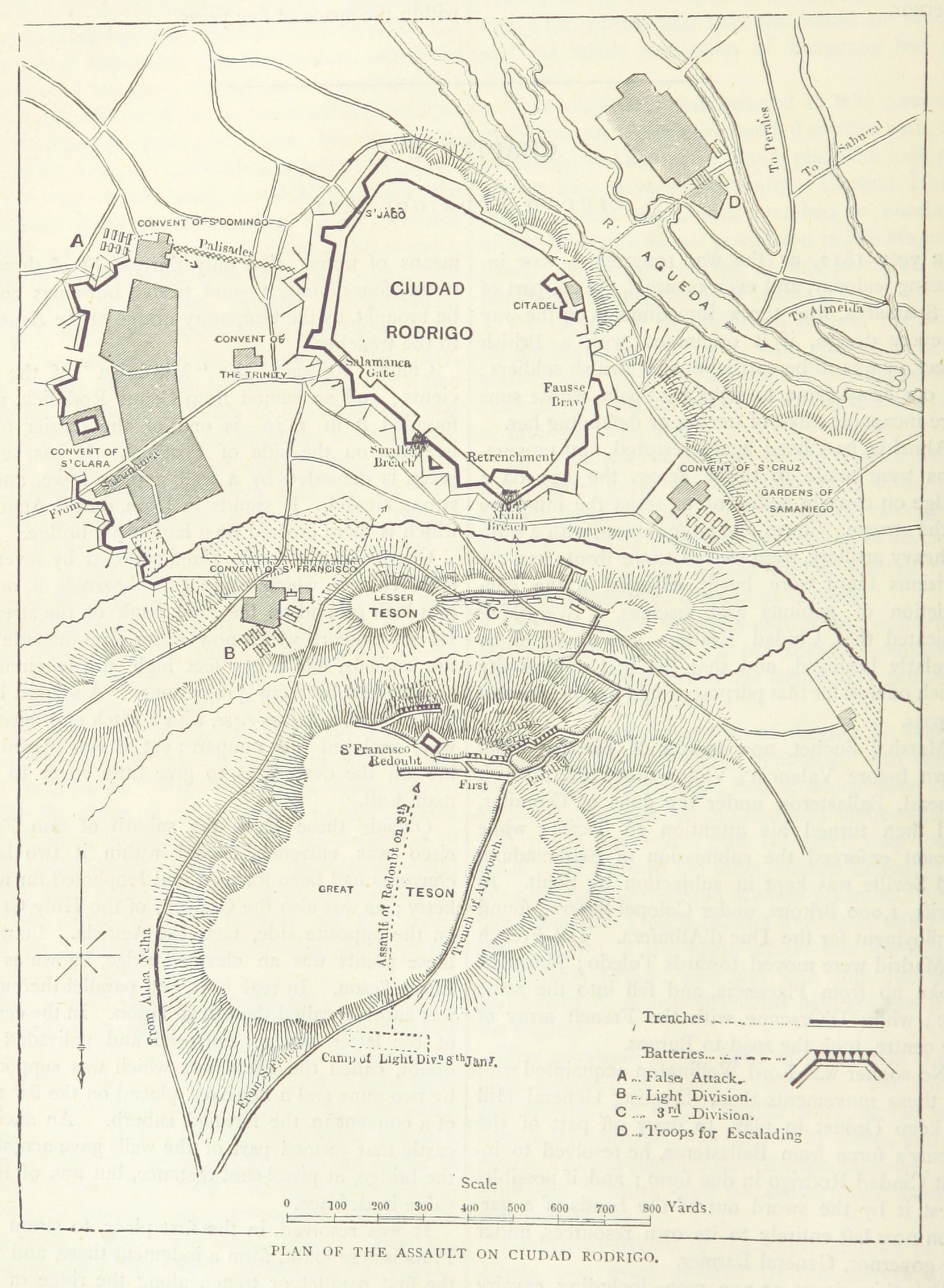
English: A map of the 1812 Siege of Ciudad Rodrigo, where English forces assaulted the French-held fortress. |
||
| Date | |||
| Source |
From p. 440 of the 1873 book British Battles on Land and Sea, volume 2. Uploaded by the British library to Flickr here.
|
||
| Author | James Grant |

_map.jpg)
Licensing
|
This work is in the public domain in its country of origin and other countries and areas where the copyright term is the author's life plus 70 years or fewer. This work is in the public domain in the United States because it was published (or registered with the U.S. Copyright Office) before January 1, 1930. | |
| This file has been identified as being free of known restrictions under copyright law, including all related and neighbouring rights. | |
File history
Click on a date/time to view the file as it appeared at that time.
| Date/Time | Thumbnail | Dimensions | User | Comment | |
|---|---|---|---|---|---|
| current | 14:21, 27 June 2015 | | 1,661 × 2,266 (596 KB) | wikimediacommons>Howicus | Rotated and cropped from original. |
File usage
There are no pages that use this file.
_map.jpg)