SMS Maria Theresia AK 1909 reverse.jpg
From Warlike
Size of this preview: 800 × 521 pixels. Other resolutions: 320 × 209 pixels | 640 × 417 pixels | 1,024 × 667 pixels | 1,280 × 834 pixels | 1,775 × 1,157 pixels.
Original file (1,775 × 1,157 pixels, file size: 558 KB, MIME type: image/jpeg)
Summary
| Description |
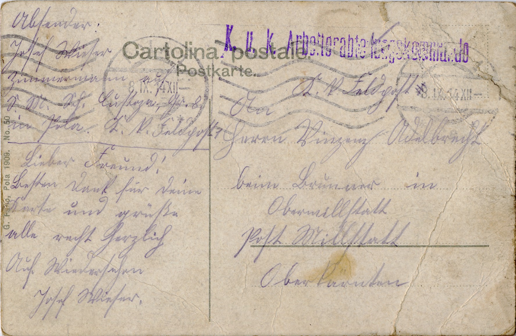
Deutsch: Feldpost aus dem Ersten Weltkrieg: Rückseite einer Ansichtskarte vom Panzerkreuzer SMS Kaiserin und Königin Maria Theresia der österreichischen k.u.k. Kriegsmarine aus Pula von 1909. Die Karte wurde am 8.9.1914 als Feldpost von Pula (damals Teil des österreichisch-Ungarischen Küstenlandes, heute Kroatien) nach Obermillstatt in Kärnten verschickt. Aufdruck: „Cartolina postale Postkarte“ Stempel: „K.u.K. Arbeitskommando“. Die Karte stammt von einem Rekruten, der auf der SMS Custoza, ein Seekadettenschulschiff (Hilfsschiff) als Zimmermann arbeitete. English: Postcard from the armored cruiser SMS Kaiserin und Königin Maria Theresia, a armored cruiser from 1893 of the Austro-Hungarian Navy. This postcard (lithograph) was sent on 09.08.1914 as field post of Pula, at that time part of the Austro-Hungarian Littoral nowadays Croatia to Obermillstatt in Carinthia. The card is from a recruit who worked on the SMS Custoza, a training ship for cadets (auxiliary boat) as a carpenter.  |
|
| Date | ||
| Source | scan and uploaded by Joadl | |
| Author | G. Fa..o, Pola | |
| Permission (Reusing this file) |
|
| Camera location | | View this and other nearby images on: OpenStreetMap |
|---|
| Object location | | View this and other nearby images on: OpenStreetMap |
|---|
Licensing
|
This work is in the public domain in its country of origin and other countries and areas where the copyright term is the author's life plus 70 years or fewer. | |
| This file has been identified as being free of known restrictions under copyright law, including all related and neighbouring rights. | |
File history
Click on a date/time to view the file as it appeared at that time.
| Date/Time | Thumbnail | Dimensions | User | Comment | |
|---|---|---|---|---|---|
| current | 17:51, 29 June 2013 | | 1,775 × 1,157 (558 KB) | wikimediacommons>Joadl | == {{int:filedesc}} == {{Information |Description= {{Multilingual description |de=Ansichtskarte vom Panzerkreuzer SMS Kaiserin und Königin Maria Theresia der österreichischen [[:de:k.u.k. Kriegsmarine|... |
File usage
There are no pages that use this file.