Pont Oléron2.JPG
From Warlike

Size of this preview: 800 × 600 pixels. Other resolutions: 320 × 240 pixels | 640 × 480 pixels | 1,024 × 768 pixels.
Original file (1,024 × 768 pixels, file size: 56 KB, MIME type: image/jpeg)
Summary
| Description |
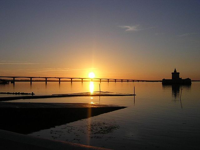
Pont de l'Île d'Oléron (Charente Maritime). Vue générale embrassant l'ensemble du Coureau d'Oléron, séparant l'île du continent. Au second plan, le Fort du Chapus. Crédit : Office de Tourisme de Bourcefranc |
| Date | 25 September 2006 (original upload date) |
| Source | Transferred from fr.wikipedia to Commons. |
| Author | The original uploader was Olivier2000 at French Wikipedia. |
Licensing
This file is licensed under the Creative Commons Attribution 2.5 Generic licence.
- You are free:
- to share – to copy, distribute and transmit the work
- to remix – to adapt the work
- Under the following conditions:
- attribution – You must give appropriate credit, provide a link to the licence, and indicate if changes were made. You may do so in any reasonable manner, but not in any way that suggests the licensor endorses you or your use.
Original upload log
The original description page was here. All following user names refer to fr.wikipedia.
- 2006-09-25 14:13 Olivier2000 1024×768×8 (56899 bytes) Pont-viaduc de l'Île d'Oléron (Charente Maritime). Vue générale embrassant le Coureau d'Oléron, séparant l'île du continent. Au second plan, le Fort du Chapus. Crédit photo : Office de Tourisme de Bourcefranc
- 2006-09-25 13:50 Olivier2000 1024×768×8 (56899 bytes) Pont de l'Île d'Oléron (Charente Maritime). Vue générale embrassant l'ensemble du Coureau d'Oléron, séparant l'île du continent. Au second plan, le Fort du Chapus. Crédit : Office de Tourisme de Bourcefranc
File history
Click on a date/time to view the file as it appeared at that time.
| Date/Time | Thumbnail | Dimensions | User | Comment | |
|---|---|---|---|---|---|
| current | 11:11, 11 April 2007 | | 1,024 × 768 (56 KB) | wikimediacommons>Frokor | {{Information |Description=Pont de l'Île d'Oléron (Charente Maritime). Vue générale embrassant l'ensemble du Coureau d'Oléron, séparant l'île du continent. Au second plan, le Fort du Chapus. Crédit : Office de Tourisme de Bourcefranc |Source=Origi |
File usage
There are no pages that use this file.