Political map of Somalia showing Jowhar.png
From Warlike
File:Political map of Somalia showing Jowhar.png
Size of this preview: 499 × 600 pixels. Other resolutions: 200 × 240 pixels | 399 × 480 pixels | 639 × 768 pixels | 852 × 1,024 pixels | 1,405 × 1,689 pixels.
Original file (1,405 × 1,689 pixels, file size: 2.32 MB, MIME type: image/png)
Summary
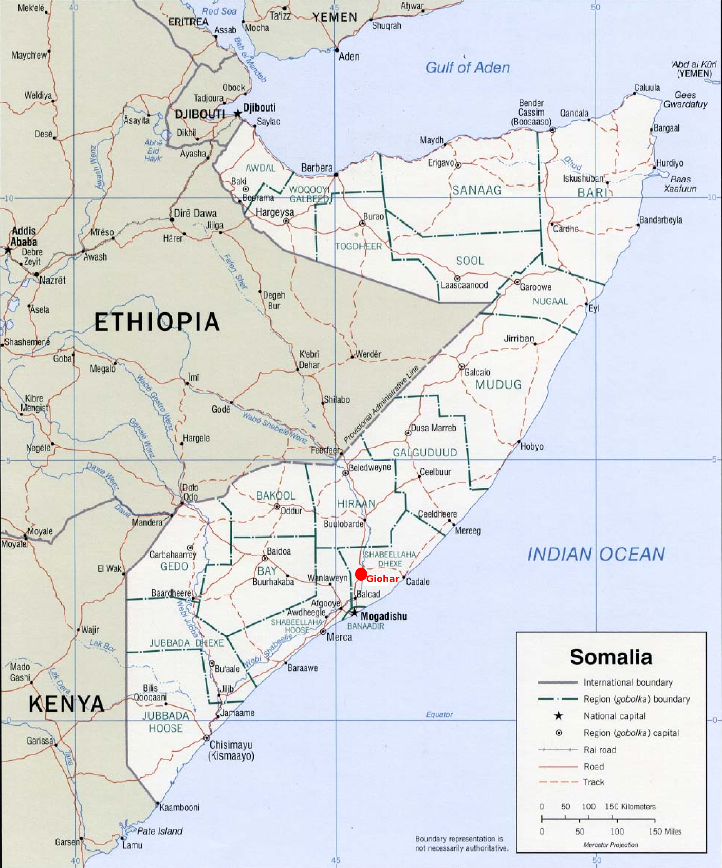
| Description | This is a political map of Somalia showing the location of Jowhar (or Giohar) north of Mogadishu with a red dot. |
| Date | |
| Source | Original political map taken from Renato Caniatti's upload at Image:Somalia_pol02.jpg, which was in turn taken from http://www.lib.utexas.edu/maps/africa/somalia_pol02.jpg. |
| Author | Jeffrey Finkelstein |
| Permission (Reusing this file) |
This derivative work is released into the Public Domain. |
Licensing
This work is in the public domain in the United States because it is a work prepared by an officer or employee of the United States Government as part of that person’s official duties under the terms of Title 17, Chapter 1, Section 105 of the US Code.
Note: This only applies to original works of the Federal Government and not to the work of any individual U.S. state, territory, commonwealth, county, municipality, or any other subdivision. This template also does not apply to postage stamp designs published by the United States Postal Service since 1978. (See § 313.6(C)(1) of Compendium of U.S. Copyright Office Practices). It also does not apply to certain US coins; see The US Mint Terms of Use.
|
 | |
| This file has been identified as being free of known restrictions under copyright law, including all related and neighbouring rights. | ||
File history
Click on a date/time to view the file as it appeared at that time.
| Date/Time | Thumbnail | Dimensions | User | Comment | |
|---|---|---|---|---|---|
| current | 15:51, 18 June 2006 | | 1,405 × 1,689 (2.32 MB) | wikimediacommons>J. Finkelstein | {{Information |Description=This is a political map of Somalia showing the location of Jowhar (or Giohar) north of Mogadishu with a red dot. |Source=Original political map taken from Renato Caniatti's upload at Image:Somalia_pol02.jpg, which was in tu |
File usage
The following 2 pages use this file: