Plan of Seringapatam and its environs.jpg
From Warlike
Size of this preview: 800 × 595 pixels. Other resolutions: 320 × 238 pixels | 640 × 476 pixels | 1,024 × 762 pixels | 1,280 × 952 pixels | 1,896 × 1,410 pixels.
Original file (1,896 × 1,410 pixels, file size: 326 KB, MIME type: image/jpeg)
Summary
| Description |
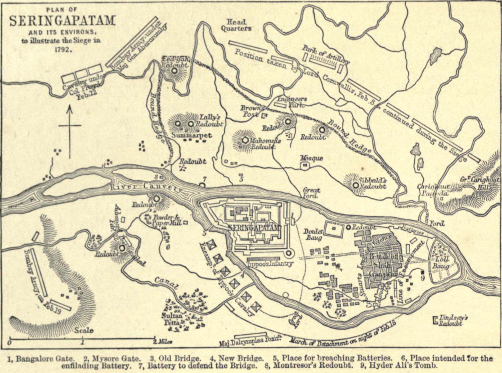
Plan of Seringapatam and its environs to illustrate the siege in 1792. |
|||||||||
| Date | published 1896 | |||||||||
| Source | G. A. Henty (1896). The Tiger of Mysore. London: Blackie & Son. p. 165. | |||||||||
| Creator |
Not identified |
|||||||||
| Geotemporal data | ||||||||||
| Bounding box |
|
|||||||||
| Georeferencing | ||||||||||
Licensing
|
This work is in the public domain in its country of origin and other countries and areas where the copyright term is the author's life plus 100 years or fewer. This work is in the public domain in the United States because it was published (or registered with the U.S. Copyright Office) before January 1, 1930. | |
| This file has been identified as being free of known restrictions under copyright law, including all related and neighbouring rights. | |
File history
Click on a date/time to view the file as it appeared at that time.
| Date/Time | Thumbnail | Dimensions | User | Comment | |
|---|---|---|---|---|---|
| current | 05:44, 29 September 2010 | | 1,896 × 1,410 (326 KB) | wikimediacommons>Spellcast | == {{int:filedesc}} == {{Information |Description=Plan of Seringapatam and its environs to illustrate the siege in 1792. |Date=Published 1896 |Source=G. A. Henty (1896). ''[http://www.archive.org/stream/tigerofmysoresto00hentuoft#page/164 The Tiger of Mys |
File usage
There are no pages that use this file.