Plan des attaques de Maestricht, 1748, BNF.jpg
From Warlike
Size of this preview: 800 × 495 pixels. Other resolutions: 320 × 198 pixels | 640 × 396 pixels | 1,024 × 633 pixels | 1,535 × 949 pixels.
Original file (1,535 × 949 pixels, file size: 549 KB, MIME type: image/jpeg)
Summary
| Description |
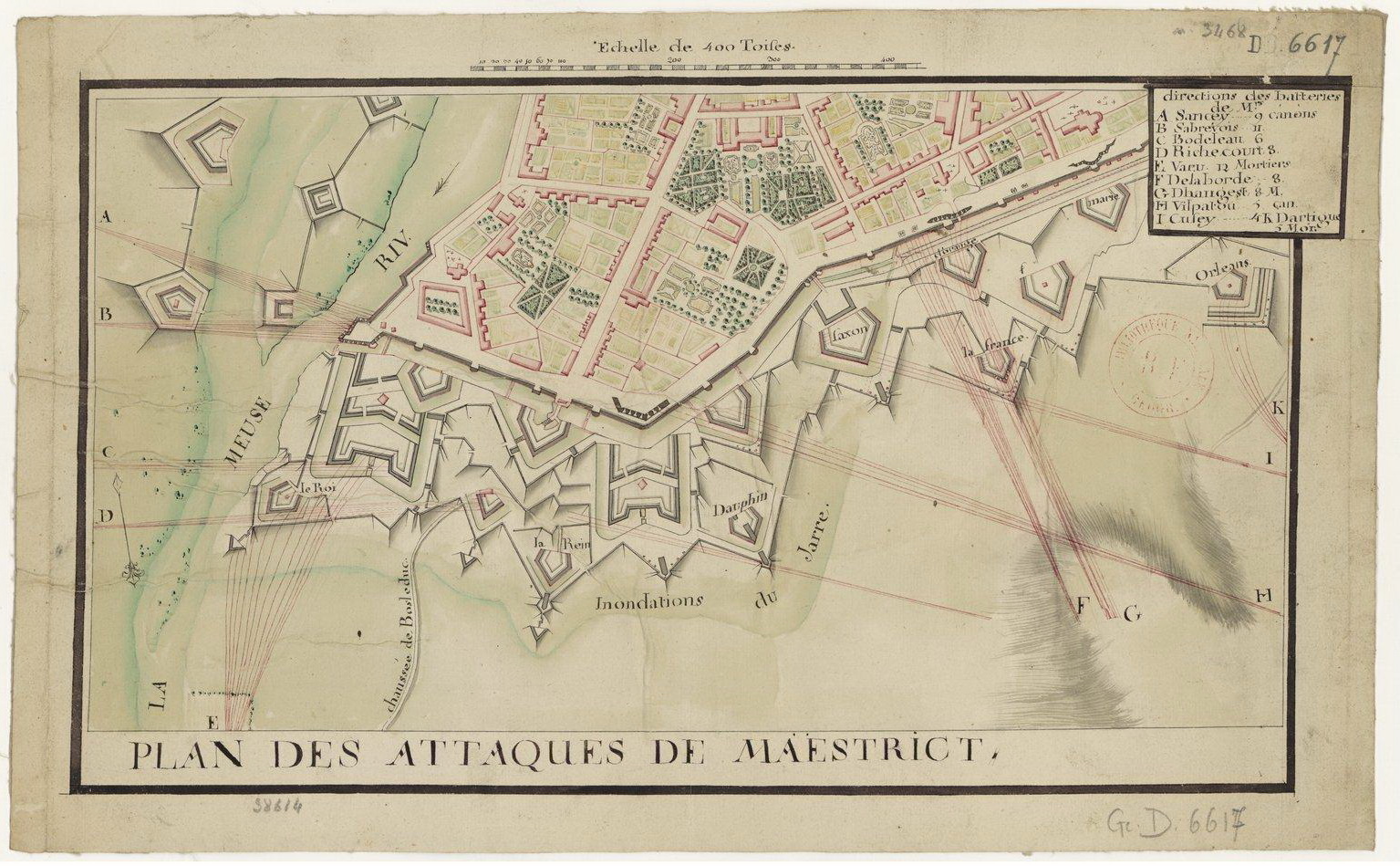
English: Old map of Maastricht, the Netherlands, showing the attaques of the army of Louis XV of France on the city in 1748 during the War of the Austrian Succession. Map in the collection of the Bibliothèque nationale de France in Paris.
Nederlands: Franse aanval op de Bossche Fronten tijdens het Beleg van Maastricht in 1748. De aanduiding "Inondations du Jarre" (Jekerinundaties) is geen vergissing: d.m.v. het in 1676 aangelegde Jekerkanaal kon het water van de Jeker naar de noordzijde van de stad worden geleid. |
| Date | |
| Source | http://gallica.bnf.fr (website Bibliothèque nationale de France) |
| Author | unknown cartographers, c.1750 |
Licensing
|
This is a faithful photographic reproduction of a two-dimensional, public domain work of art. The work of art itself is in the public domain for the following reason:
The official position taken by the Wikimedia Foundation is that "faithful reproductions of two-dimensional public domain works of art are public domain".
This photographic reproduction is therefore also considered to be in the public domain in the United States. In other jurisdictions, re-use of this content may be restricted; see Reuse of PD-Art photographs for details. | ||||
File history
Click on a date/time to view the file as it appeared at that time.
| Date/Time | Thumbnail | Dimensions | User | Comment | |
|---|---|---|---|---|---|
| current | 08:05, 16 June 2014 | | 1,535 × 949 (549 KB) | wikimediacommons>Kleon3 | User created page with UploadWizard |