Ordnance Survey Sheet NH 75 Fortrose, Published 1961.jpg
From Warlike

Size of this preview: 520 × 599 pixels. Other resolutions: 208 × 240 pixels | 417 × 480 pixels | 667 × 768 pixels | 889 × 1,024 pixels | 1,778 × 2,048 pixels | 7,592 × 8,745 pixels.
Original file (7,592 × 8,745 pixels, file size: 15.22 MB, MIME type: image/jpeg)
Summary
| Description |
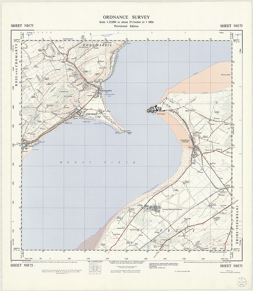
English: OS map of Fortrose, at a scale of 1:25,000 |
| Date | |
| Source | https://maps.nls.uk/view/196179285 |
| Author | Director General of the Ordnance Survey, UK |
Licensing
Original map:
This work is an Ordnance Survey map over 50 years old, which is covered by Crown Copyright which in this case expires 50 years after publication. Ordnance Survey does however ask that they be credited and that the date of publication be given.
Any ancillary rights gained through the creation of the electronic version are granted as freely usable under any circumstances.
|
This work created by an employee of the Government of the United Kingdom is in the public domain.
This is because it falls under one (or more) of the following:
HMSO has declared that the expiry of crown copyright applies worldwide (ref: HMSO email reply)
|
 |
Any derivative rights in the digital version have been released by the National Library of Scotland under the following license:
This file is licensed under the Creative Commons Attribution 4.0 International licence.
- You are free:
- to share – to copy, distribute and transmit the work
- to remix – to adapt the work
- Under the following conditions:
- attribution – You must give appropriate credit, provide a link to the licence, and indicate if changes were made. You may do so in any reasonable manner, but not in any way that suggests the licensor endorses you or your use.
File history
Click on a date/time to view the file as it appeared at that time.
| Date/Time | Thumbnail | Dimensions | User | Comment | |
|---|---|---|---|---|---|
| current | 15:38, 10 April 2022 | | 7,592 × 8,745 (15.22 MB) | wikimediacommons>Kognos | Uploaded a work by Director General of the Ordnance Survey, UK from https://maps.nls.uk/view/196179285 with UploadWizard |
File usage
There are no pages that use this file.