Ohio Country en.png
From Warlike
File:Ohio Country en.png
Size of this preview: 793 × 599 pixels. Other resolutions: 318 × 240 pixels | 635 × 480 pixels | 1,016 × 768 pixels | 1,217 × 920 pixels.
Original file (1,217 × 920 pixels, file size: 1.41 MB, MIME type: image/png)
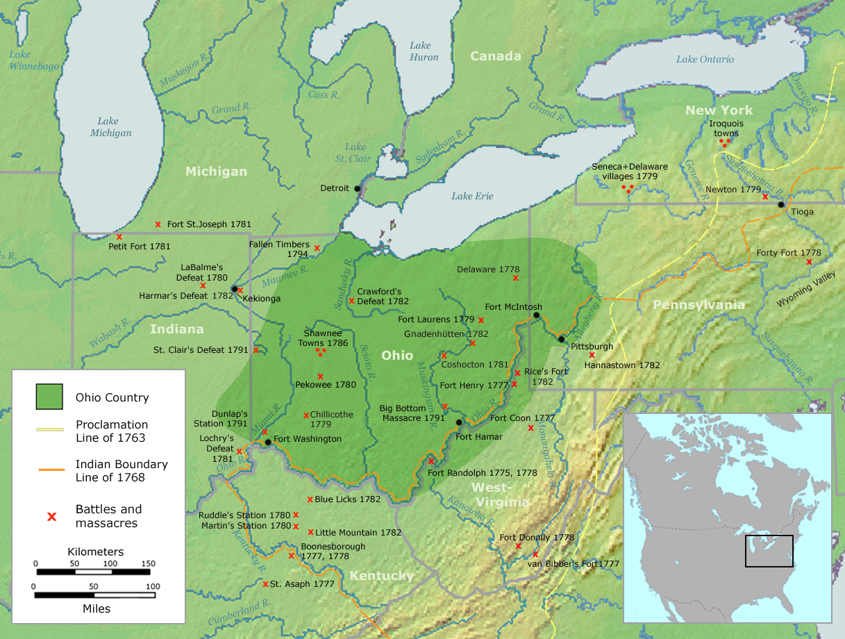
| Description | Map of the Ohio Country (English version) | ||||
| Date | |||||
| Source | Own work by Nikater, submitted to the public domain. Background map courtesy of Demis, www.demis.nl and Wilcomb E. Washburn (Hrsg.) Handbook of North American Indians. Vol. 4: History of Indian-White Relations. Smithsonian Institution Press, Washington D.C. 1988. ISBN 0-16004-583-5 | ||||
| Author | User:Nikater | ||||
| Permission (Reusing this file) |
|
||||
| Other versions | Deutsch |
File history
Click on a date/time to view the file as it appeared at that time.
| Date/Time | Thumbnail | Dimensions | User | Comment | |
|---|---|---|---|---|---|
| current | 06:20, 21 September 2007 | | 1,217 × 920 (1.41 MB) | wikimediacommons>Nikater | {{Information |Description=Map of the Ohio Country (English version) |Source=Own work by Nikater, submitted to the public domain. Background map courtesy of Demis, www.demis.nl and Wilcomb E. Washburn (Hrsg.) ''Handbook of North American Indians.'' Vol. 4 |
File usage
The following page uses this file: