Naktong Defense.jpg
From Warlike
Size of this preview: 372 × 599 pixels. Other resolutions: 149 × 240 pixels | 587 × 945 pixels.
Original file (587 × 945 pixels, file size: 427 KB, MIME type: image/jpeg)
Summary
| Description |
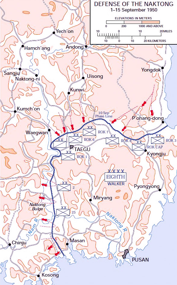
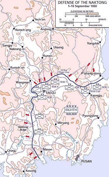
English: Map of the Naktong Defense lines, September 1950. This map was created by the United States Army Center of Military History (USACMH) and used in the brochure "The Korean War: The Outbreak" located at [1]. |
| Date | 27 December 2006 (original upload date) |
| Source | Transferred from en.wikipedia to Commons. |
| Author | The original uploader was Wbfergus at English Wikipedia. |
| Other versions |
|
.jpg)
.jpg)
.jpg)
.jpg)
.jpg)
Original upload log
The original description page was here. All following user names refer to en.wikipedia.
- 2006-12-27 13:30 Wbfergus 350×572×8 (48792 bytes) Map of the Naktong Defense lines, September 1950. This map was created by the Center for Military History and used in the brochure "The Korean War: The Outbreak" located at [2].
Licensing
This file is a work of a U.S. Army soldier or employee, taken or made as part of that person's official duties. As a work of the U.S. federal government, it is in the public domain in the United States.
|
 |
File history
Click on a date/time to view the file as it appeared at that time.
| Date/Time | Thumbnail | Dimensions | User | Comment | |
|---|---|---|---|---|---|
| current | 18:40, 25 November 2016 | | 587 × 945 (427 KB) | wikimediacommons>Julien1978 | saturation |