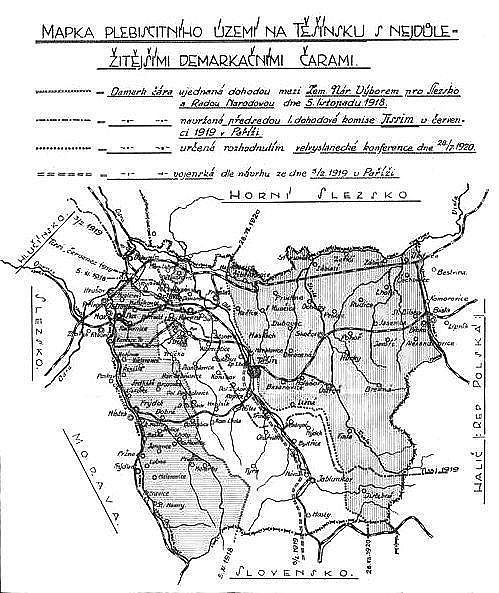
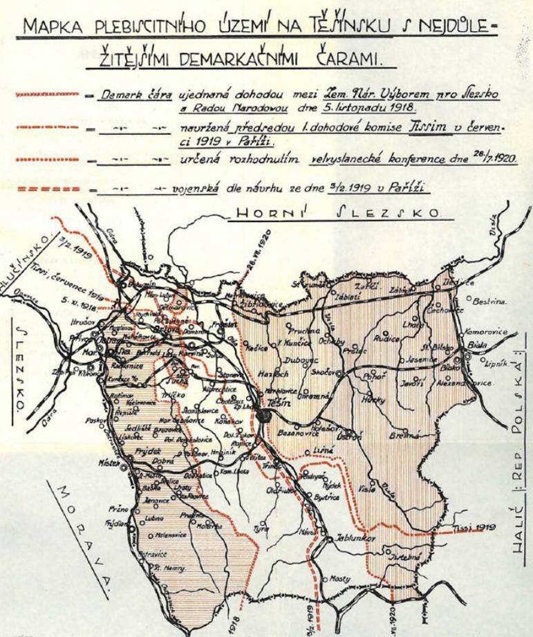
Map of plebiscite area.jpg
From Warlike
File:Map of plebiscite area.jpg
No higher resolution available.
Map_of_plebiscite_area.jpg (499 × 593 pixels, file size: 100 KB, MIME type: image/jpeg)
Summary
| Description |
English: Map of the plebiscite area of Cieszyn Silesia during the dispute between Czechoslovakia and Poland over Teschen Silesia in 1918 - 1920. The descriptions on the map are in Czech. |
| Date | or before |
| Source | Dr. Ferdinand Pelc: O Těšínsko. Vzpomínky a úvahy, published by Slezská Matice osvěty lidové in Slezská Ostrava in 1928 |
| Author | Unknown author |
| Other versions | higher resolution colour version with slightly cropped bottom |
Licensing
|
This work is in the public domain in its country of origin and other countries and areas where the copyright term is the author's life plus 70 years or fewer. | |
| This file has been identified as being free of known restrictions under copyright law, including all related and neighbouring rights. | |
File history
Click on a date/time to view the file as it appeared at that time.
| Date/Time | Thumbnail | Dimensions | User | Comment | |
|---|---|---|---|---|---|
| current | 14:03, 14 August 2008 | | 499 × 593 (100 KB) | wikimediacommons>MonkeymanT | {{Information |Description={{en|1=Map of the plebiscite area of Teschen Silesia during the dispute between Czechoslovakia and Poland over Teschen Silesia in 1918 - 1920. The descriptions on the map are in Czech.}} |Source=Dr. Ferdinand Pelc: O Těšínsko |
File usage
The following page uses this file: