Linz TorNeu.jpg
From Warlike

Size of this preview: 377 × 599 pixels. Other resolutions: 151 × 240 pixels | 302 × 480 pixels | 483 × 768 pixels | 645 × 1,024 pixels | 2,165 × 3,438 pixels.
Original file (2,165 × 3,438 pixels, file size: 3.17 MB, MIME type: image/jpeg)
Summary
| Description |
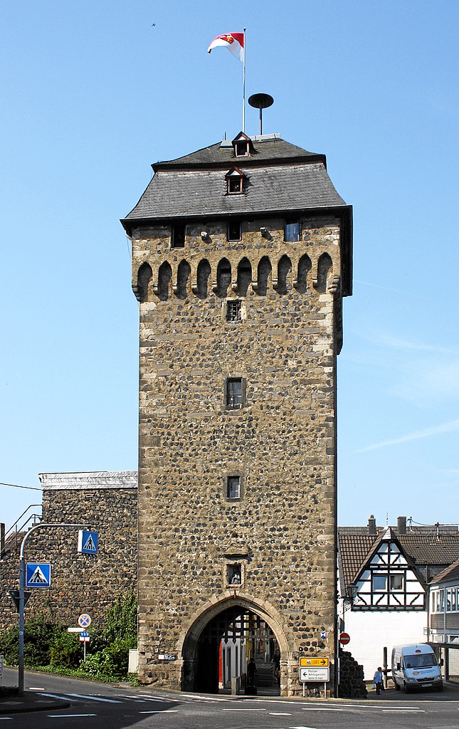
English: Linz am Rhein, Germany. Neutor of the former city walls build in 14th century, view from North-East.
Deutsch: Linz am Rhein, Deutschland. Neutor der ehemaligen Stadtmauer, Ansicht aus Nordost (Feldseite). |
| Date | |
| Source | Own work |
| Author | Beckstet |
| Camera location | | View this and other nearby images on: OpenStreetMap |
|---|
| Object location | | View this and other nearby images on: OpenStreetMap |
|---|
Licensing
I, the copyright holder of this work, hereby publish it under the following licences:
This file is licensed under the Creative Commons Attribution-Share Alike 3.0 Unported licence.
- You are free:
- to share – to copy, distribute and transmit the work
- to remix – to adapt the work
- Under the following conditions:
- attribution – You must give appropriate credit, provide a link to the licence, and indicate if changes were made. You may do so in any reasonable manner, but not in any way that suggests the licensor endorses you or your use.
- share alike – If you remix, transform, or build upon the material, you must distribute your contributions under the same or compatible licence as the original.

|
Permission is granted to copy, distribute and/or modify this document under the terms of the GNU Free Documentation Licence, Version 1.2 or any later version published by the Free Software Foundation; with no Invariant Sections, no Front-Cover Texts, and no Back-Cover Texts. A copy of the licence is included in the section entitled GNU Free Documentation Licence. |
You may select the licence of your choice.
File history
Click on a date/time to view the file as it appeared at that time.
| Date/Time | Thumbnail | Dimensions | User | Comment | |
|---|---|---|---|---|---|
| current | 12:18, 30 June 2010 | | 2,165 × 3,438 (3.17 MB) | wikimediacommons>Beckstet | Perspective correction with FixFoto 3. |
File usage
The following page uses this file: