Iuka-Corinth Campaign2.png
From Warlike
File:Iuka-Corinth Campaign2.png
Size of this preview: 776 × 600 pixels. Other resolutions: 311 × 240 pixels | 621 × 480 pixels | 994 × 768 pixels | 1,280 × 989 pixels | 2,560 × 1,978 pixels | 3,300 × 2,550 pixels.
Original file (3,300 × 2,550 pixels, file size: 2.78 MB, MIME type: image/png)
Summary
| Description |
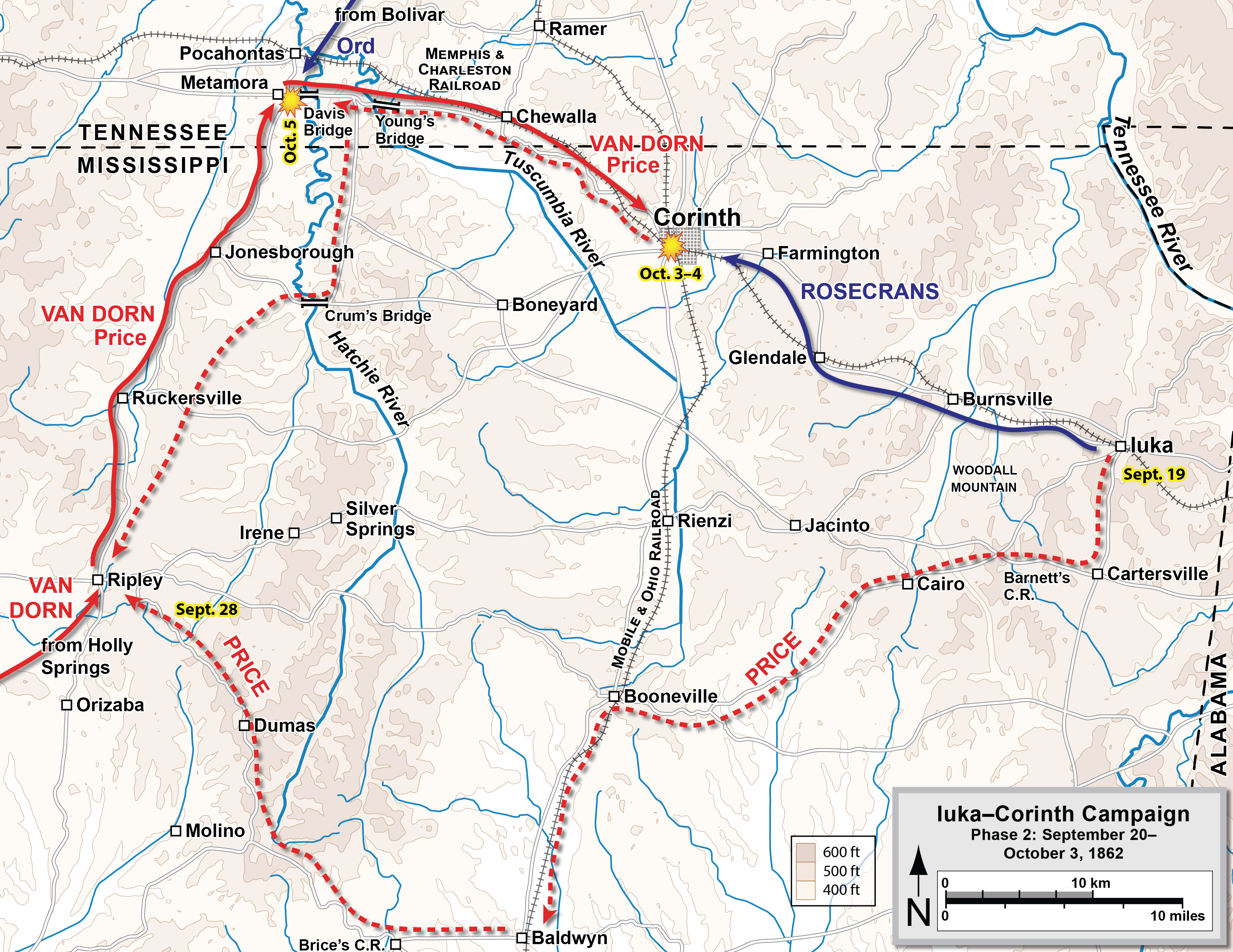
English: Iuka-Corinth Campaign of the American Civil War, part 2. |
| Date | 2 April 2006 (original upload date) |
| Source |
|
| Author |
Hal Jespersen at en.wikipedia, the copyright holder of this work, hereby publishes it under the following licence: This file is licensed under the Creative Commons Attribution 3.0 Unported licence. Attribution: Map by Hal Jespersen, www.cwmaps.com
|
Original upload log
The original description page was here. All following user names refer to en.wikipedia.
- 2011-03-31 22:20 Hlj 2585×1703× (431232 bytes) Updated graphical format of rivers and roads.
- 2009-11-22 23:18 Hlj 2646×1729× (370883 bytes) {{Information |Description=Map of the Iuka-Corinth Campaign, phase 2, of the [[American Civil War]]. Drawn in Adobe Illustrator CS3 by Hal Jespersen. Graphic source file is available at http://www.posix.com/CWmaps/ . Modified version corrects some troop l
- 2006-04-02 18:57 Hlj 2499×1589× (586210 bytes) Iuka-Corinth Campaign of the [[American Civil War]], part 2. Drawn by Hal Jespersen in Macromedia Freehand. Graphic source file is available at http://www.posix.com/CWmaps/ {{PD-release}}
File history
Click on a date/time to view the file as it appeared at that time.
| Date/Time | Thumbnail | Dimensions | User | Comment | |
|---|---|---|---|---|---|
| current | 22:44, 25 December 2018 | | 3,300 × 2,550 (2.78 MB) | wikimediacommons>Hlj | Updated to improve geographic content, including the course of the Tuscumbia River. Added elevations. Improved graphics. Adobe Illustrator source file available at http://www.cwmaps.com/freemaps.html. |
File usage
The following 3 pages use this file: