India Red Corridor map.png
From Warlike
File:India Red Corridor map.png
No higher resolution available.
India_Red_Corridor_map.png (530 × 599 pixels, file size: 369 KB, MIME type: image/png)
File history
Click on a date/time to view the file as it appeared at that time.
| Date/Time | Thumbnail | Dimensions | User | Comment | |
|---|---|---|---|---|---|
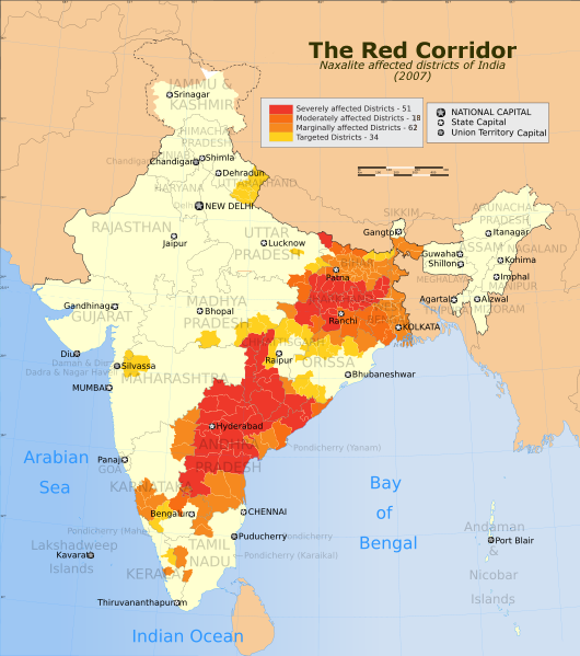
| current | 17:01, 27 October 2008 | | 530 × 599 (369 KB) | wikimediacommons>Hunnjazal | {{Information |Description=The Red Corridor. A relatively underdeveloped region in eastern India that has w:Naxalite communist militant activity. |Source=*Image:India_Naxal_affected_districts_map.svg |Date=2008-10-27 16:58 (UTC) |Author=*derivat |
File usage
There are no pages that use this file.