Horst.JPG
From Warlike
File:Horst.JPG

Size of this preview: 800 × 536 pixels. Other resolutions: 320 × 214 pixels | 640 × 429 pixels | 1,024 × 686 pixels | 1,280 × 857 pixels | 1,840 × 1,232 pixels.
Original file (1,840 × 1,232 pixels, file size: 1.01 MB, MIME type: image/jpeg)
Summary
| Description |
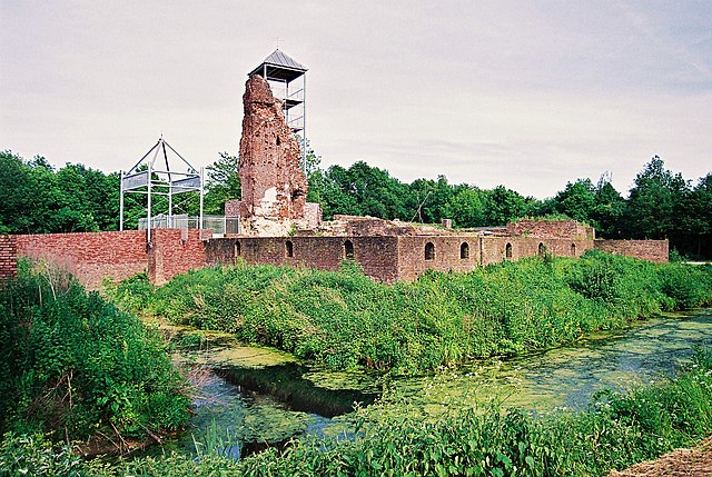
Nederlands: De ruine van 't Huis ter Horst te Horst aan de Maas.
|
||
| Date | 28 May 2005 (from Exif) | ||
| Source | Own work | ||
| Author | Kasteelbeer |
| Object location | | View this and other nearby images on: OpenStreetMap |
|---|
Licensing
This image was uploaded as part of Wiki Loves Monuments 2010.
|
I, the copyright holder of this work, hereby publish it under the following licence:
This file is licensed under the Creative Commons Attribution-Share Alike 3.0 Netherlands licence.
- You are free:
- to share – to copy, distribute and transmit the work
- to remix – to adapt the work
- Under the following conditions:
- attribution – You must give appropriate credit, provide a link to the licence, and indicate if changes were made. You may do so in any reasonable manner, but not in any way that suggests the licensor endorses you or your use.
- share alike – If you remix, transform, or build upon the material, you must distribute your contributions under the same or compatible licence as the original.

File history
Click on a date/time to view the file as it appeared at that time.
| Date/Time | Thumbnail | Dimensions | User | Comment | |
|---|---|---|---|---|---|
| current | 16:32, 19 September 2010 | | 1,840 × 1,232 (1.01 MB) | wikimediacommons>Kasteelbeer | {{Information |Description = {{nl|1=De ruine van 't Huis ter Horst te Horst aan de Maas.}} {{Rijksmonument|22650}} |Source = {{own}} |Author = User:Kasteelbeer |Date = {{Date|{{subst:#time:Y}}|{{subst:#time:m}}|{{subst:#time:d}}}} (upload date) }} [ |
File usage
The following page uses this file: