Hoitorpfortet rekkevidde (1731).jpg
From Warlike

Size of this preview: 739 × 600 pixels. Other resolutions: 296 × 240 pixels | 591 × 480 pixels | 946 × 768 pixels | 1,262 × 1,024 pixels | 2,523 × 2,048 pixels | 3,288 × 2,669 pixels.
Original file (3,288 × 2,669 pixels, file size: 3.64 MB, MIME type: image/jpeg)
Summary
| Description |
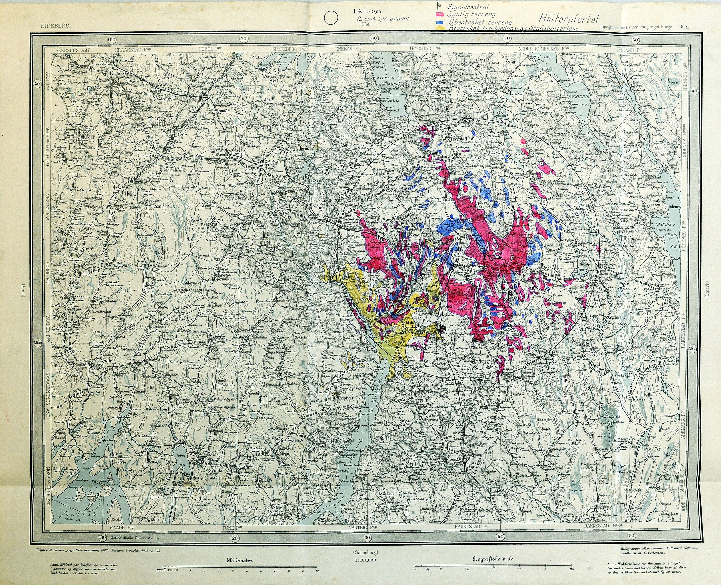
Norsk bokmål: Kart over Höitorpfortets rekkevidde mm. |
|||
| Source | Own work / Riksarkivet, RAFA-4F-10924 / Fossumstrøket festning | |||
| Author | Norges geografiske oppmaaling / Prml Normann | |||
| Permission (Reusing this file) |
|

.jpg)
| Annotations | This image is annotated: View the annotations at Commons |
File history
Click on a date/time to view the file as it appeared at that time.
| Date/Time | Thumbnail | Dimensions | User | Comment | |
|---|---|---|---|---|---|
| current | 15:28, 20 March 2010 | | 3,288 × 2,669 (3.64 MB) | wikimediacommons>TommyG | == {{int:filedesc}} == {{Information |Description={{no|Kart over Höitorpfortets rekkevidde mm.}} |Source={{own}} / Riksarkivet, RAFA-4F-10924 / Fossumstrøket festning |Author=Norges geografiske oppmaaling / Prml Normann |Date= |Permission={{PD-NorwayGov |
File usage
There are no pages that use this file.
.jpg)