Hirta (27657381514).jpg
From Warlike
File:Hirta (27657381514).jpg

Size of this preview: 800 × 533 pixels. Other resolutions: 320 × 213 pixels | 640 × 427 pixels | 1,024 × 683 pixels | 1,280 × 853 pixels | 2,560 × 1,707 pixels | 4,134 × 2,756 pixels.
Original file (4,134 × 2,756 pixels, file size: 8.03 MB, MIME type: image/jpeg)
.jpg)
Summary
| Description |
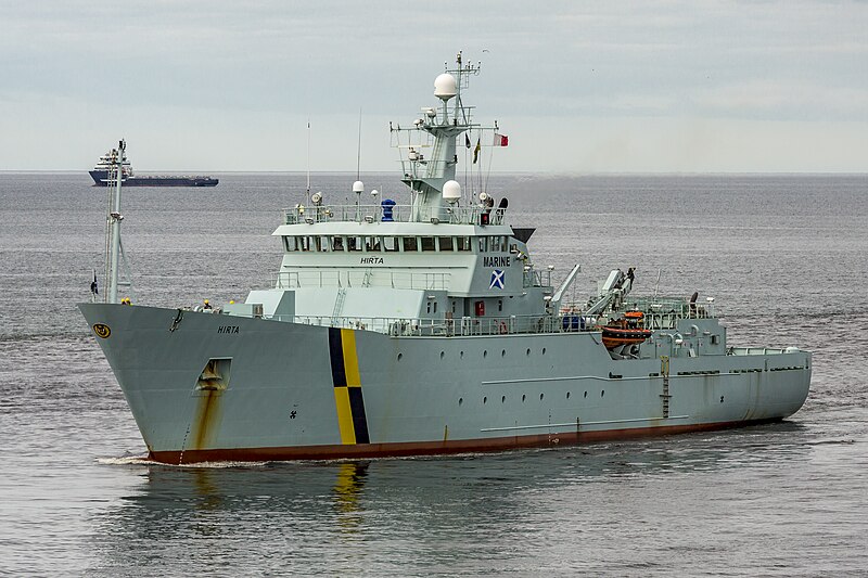
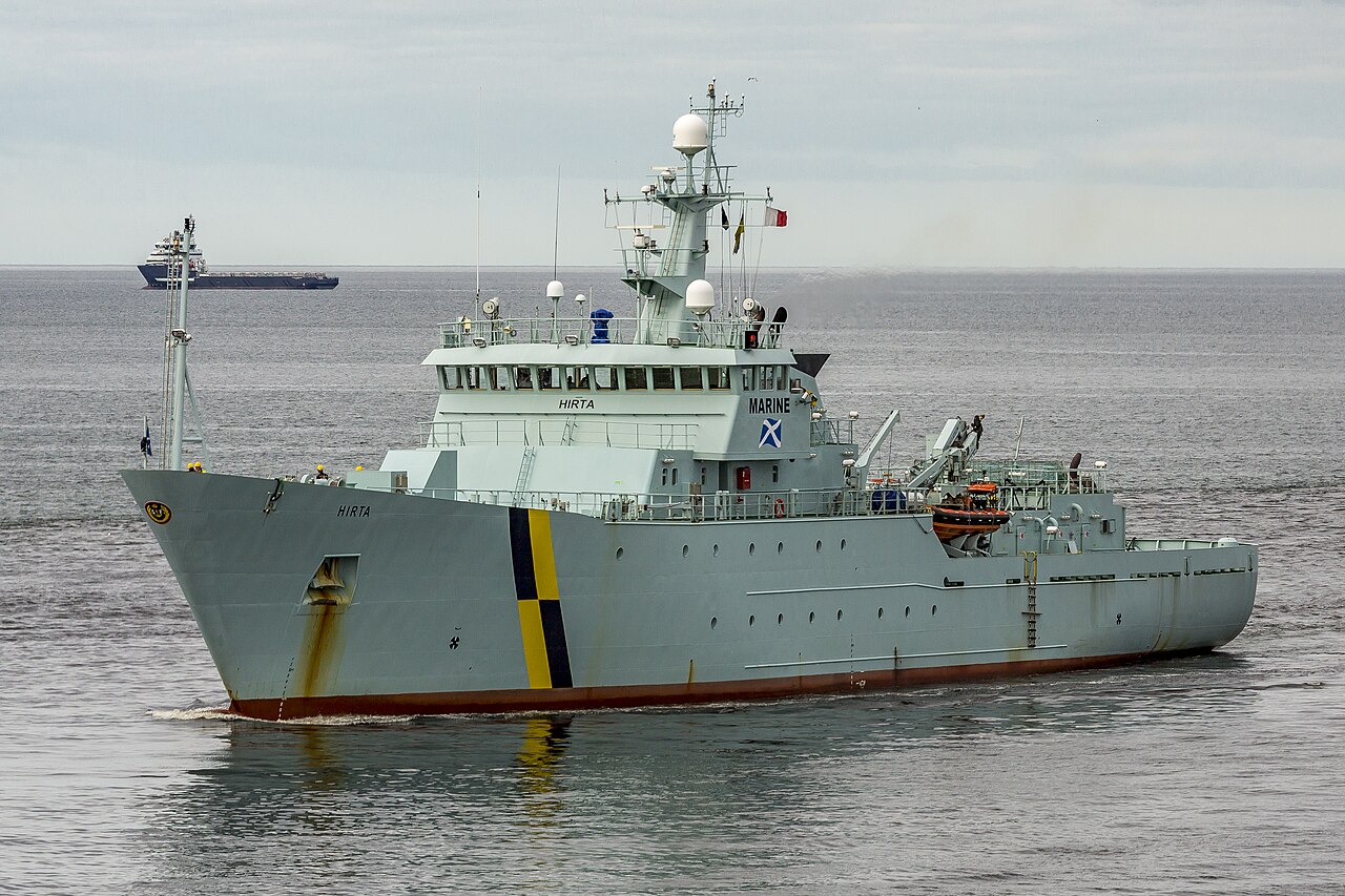
Fisheries Protection Vessel, IMO: 9386794 MMSI: 235061329 Call Sign: 2ANO9 Flag: United Kingdom [GB] AIS Vessel Type: Law Enforce Gross Tonnage: 2182 Deadweight: 741 t Length Overall x Breadth Extreme: 84.02m × 13.1m Year Built: 2007 |
| Date | |
| Source | Hirta |
| Author | Alan Jamieson from Aberdeen, Scotland |
| Camera location | | View this and other nearby images on: OpenStreetMap |
|---|
.jpg¶ms=057.144598_N_-002.060558_E_globe:Earth_type:camera_source:Flickr_&language=en-gb)
Licensing
This file is licensed under the Creative Commons Attribution 2.0 Generic licence.
- You are free:
- to share – to copy, distribute and transmit the work
- to remix – to adapt the work
- Under the following conditions:
- attribution – You must give appropriate credit, provide a link to the licence, and indicate if changes were made. You may do so in any reasonable manner, but not in any way that suggests the licensor endorses you or your use.
| This image was originally posted to Flickr by Alan-Jamieson at https://flickr.com/photos/87525421@N06/27657381514. It was reviewed on 19 March 2017 by FlickreviewR and was confirmed to be licensed under the terms of the cc-by-2.0. |
File history
Click on a date/time to view the file as it appeared at that time.
| Date/Time | Thumbnail | Dimensions | User | Comment | |
|---|---|---|---|---|---|
| current | 21:54, 19 March 2017 | | 4,134 × 2,756 (8.03 MB) | wikimediacommons>Tm | Transferred from Flickr via Flickr2Commons |
File usage
The following page uses this file:
.jpg)