Fort Rocchetta 4D (view 1).jpg
From Warlike

Size of this preview: 768 × 600 pixels. Other resolutions: 307 × 240 pixels | 615 × 480 pixels | 983 × 768 pixels | 1,280 × 1,000 pixels | 2,560 × 2,000 pixels | 5,760 × 4,500 pixels.
Original file (5,760 × 4,500 pixels, file size: 5.25 MB, MIME type: image/jpeg)
.jpg)
Summary
| Description |
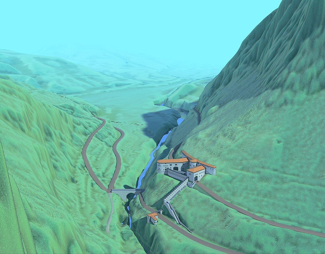
English: 4D reconstruction of Fort Rocchetta. The digital model restores the 3 spatial coordinates (x,y,z) and the 4th temporal coordinates (t) of the Fort Rocchetta, build between 1860 and 1864 and currently destroyed.
Italiano: Ricostruzione archeologica 4D del Forte Rocchetta (Strassensperre Rocchetta). Il modello digitale restituisce le 3 coordinate spaziali (x,y,z) e quella temporale (t) dell'edificio negli anni della sua costruzione (1860-1864). La struttura si trova attualmente allo stato di ruderi, in gran parte sepolti o obliterati dal moderno assetto stradale. |
| Date | |
| Source | https://arc-team-open-research.blogspot.com/2019/02/4d-reconstruction-of-fort-rocchetta.html |
| Author | Cicero Moraes (Arc-Team) - 3D reconstruction; Alessandro Bezzi and Luca Bezzi (Arc-Team) - archaeological research; Rupert Gietl (Arc-Team) - historical research |
Licensing
This file is licensed under the Creative Commons Attribution 4.0 International licence.
- You are free:
- to share – to copy, distribute and transmit the work
- to remix – to adapt the work
- Under the following conditions:
- attribution – You must give appropriate credit, provide a link to the licence, and indicate if changes were made. You may do so in any reasonable manner, but not in any way that suggests the licensor endorses you or your use.
File history
Click on a date/time to view the file as it appeared at that time.
| Date/Time | Thumbnail | Dimensions | User | Comment | |
|---|---|---|---|---|---|
| current | 11:48, 5 April 2019 | | 5,760 × 4,500 (5.25 MB) | wikimediacommons>Luca Bezzi 1979 | User created page with UploadWizard |
File usage
There are no pages that use this file.
.jpg)