Easter Island 1770 map by Aguera.jpg
From Warlike
Size of this preview: 800 × 584 pixels. Other resolutions: 320 × 233 pixels | 640 × 467 pixels | 1,024 × 747 pixels | 1,280 × 934 pixels | 2,340 × 1,707 pixels.
Original file (2,340 × 1,707 pixels, file size: 608 KB, MIME type: image/jpeg)
Summary
| Description |
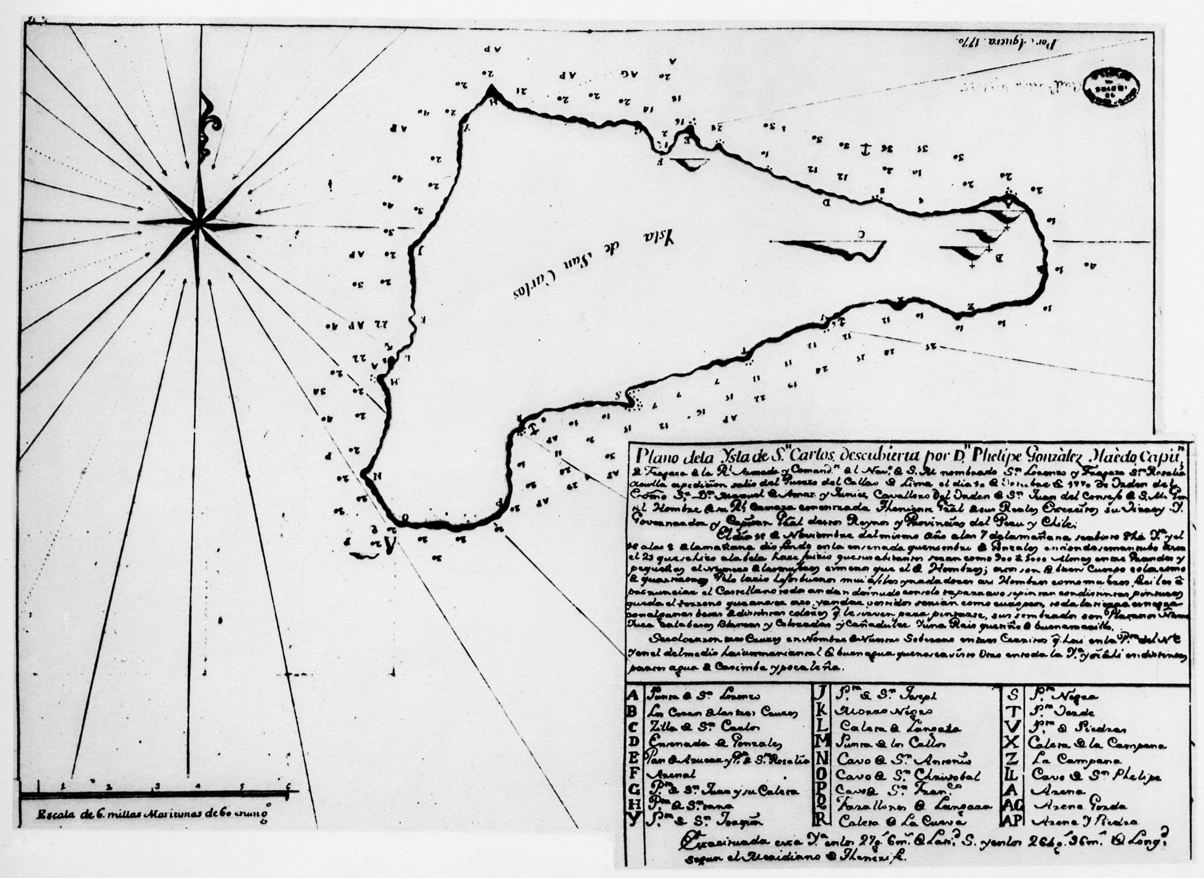
English: drawn in 1770 by Aguera, a Spanish officer on the warship San Lorenzo, which, accompanied by the frigate Santa Rosalia, was sent by Dom Manuel de Amat y de Junyent, the viceroy of Peru, to explore Easter Island, known as Davis Island, and to study the natives. The San Lorenzo was under the command of Gonzáles de Haedo who called the island San Carlos Island. The map includes three crosses that were erected, on three small hills, by Gonzáles, to signify a claim to the island. The numbers around the island indicate the depth of the water, calculated in units (fathoms) of six Castilian feet. The scale indicates one nautical mile (Archivo de India, Seville). |
| Date | |
| Source | |
| Author | Don Francisco Antonio de Agüera y Infanzon[1] (Spanish officer on the warship San Lorenzo) |
Licensing
|
This work is in the public domain in its country of origin and other countries and areas where the copyright term is the author's life plus 70 years or fewer. This work is in the public domain in the United States because it was published (or registered with the U.S. Copyright Office) before January 1, 1930. | |
| This file has been identified as being free of known restrictions under copyright law, including all related and neighbouring rights. | |
File history
Click on a date/time to view the file as it appeared at that time.
| Date/Time | Thumbnail | Dimensions | User | Comment | |
|---|---|---|---|---|---|
| current | 13:31, 5 February 2018 | | 2,340 × 1,707 (608 KB) | wikimediacommons>Ratzer | User created page with UploadWizard |
File usage
There are no pages that use this file.