BayOfMaine1713.jpg
From Warlike
File:BayOfMaine1713.jpg
Size of this preview: 800 × 567 pixels. Other resolutions: 320 × 227 pixels | 640 × 454 pixels | 1,024 × 726 pixels | 1,280 × 908 pixels | 2,761 × 1,958 pixels.
Original file (2,761 × 1,958 pixels, file size: 2.23 MB, MIME type: image/jpeg)
Summary
| Description |
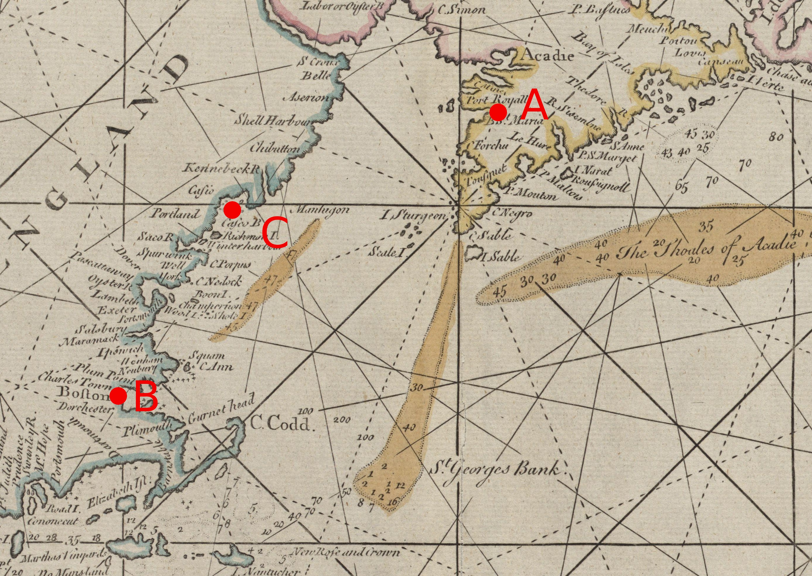
Detail from a 1713 map showing the Gulf of Maine and the Bay of Fundy, an area that saw conflict in the War of the Spanish Succession. Map is annotated as follows:
|
| Date | published 1713 |
| Source | Boston Public Library digital map collection, Call Number: G3320 1713 .T56: http://maps.bpl.org/details_10062/ |
| Author | John Thornton; annotations by User:Magicpiano |
Licensing
Annotations lack sufficient creativity to qualify as copyrightable work. The underlying map is:
|
This is a faithful photographic reproduction of a two-dimensional, public domain work of art. The work of art itself is in the public domain for the following reason:
The official position taken by the Wikimedia Foundation is that "faithful reproductions of two-dimensional public domain works of art are public domain". This photographic reproduction is therefore also considered to be in the public domain in the United States. In other jurisdictions, re-use of this content may be restricted; see Reuse of PD-Art photographs for details. {{PD-Art}} template without license parameter: please specify why the underlying work is public domain in both the source country and the United States
(Usage: {{PD-Art|1=|deathyear=''year of author's death''|country=''source country''}}, where parameter 1= can be PD-old-auto, PD-old-auto-expired, PD-old-auto-1996, PD-old-100 or similar. See Commons:Multi-license copyright tags for more information.) | ||||
File history
Click on a date/time to view the file as it appeared at that time.
| Date/Time | Thumbnail | Dimensions | User | Comment | |
|---|---|---|---|---|---|
| current | 22:14, 30 November 2010 | | 2,761 × 1,958 (2.23 MB) | wikimediacommons>Magicpiano | {{Information |Description=Detail from a 1713 map showing the w:Gulf of Maine and the w:Bay of Fundy, an area that saw conflict in the w:War of the Spanish Succession. Map is annotated as follows: *A: [[w:Port Royal, Nova Scotia|Port Royal |
File usage
The following 8 pages use this file: