Battle of Tadmur.svg
From Warlike
File:Battle of Tadmur.svg

Size of this PNG preview of this SVG file: 800 × 415 pixels. Other resolutions: 320 × 166 pixels | 640 × 332 pixels | 1,024 × 532 pixels | 1,280 × 664 pixels | 2,560 × 1,329 pixels | 863 × 448 pixels.
Original file (SVG file, nominally 863 × 448 pixels, file size: 544 KB)
Summary
| Description |
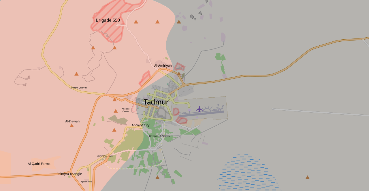
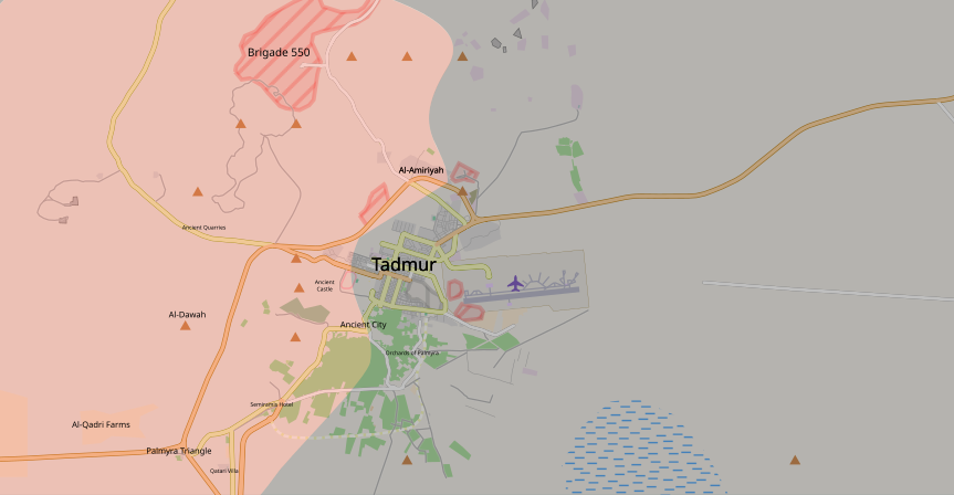
Tadmur (Arabic: تدمر; ancient Palmyra, Homs Governorate). Map of the current situation during the Palmyra offensive (March 2016). After updating this map, please also update the date(s) at w:Module:Iraq Syria map date, used to denote the date in articles. Controlled by the Syrian Armed Forces
Controlled by the Islamic State of Iraq and the Levant
The disputed frontline between the forces |
||||
| Date | |||||
| Source | Own work | ||||
| Author | Bolter21 | ||||
| Other versions |
Note: Comments "areas of activity" means that this is not territorial control is shown.
|


.svg)


.svg)


.svg)


_Territory_Change_2014-2016.gif)

_(within_Northern_Syria).svg)


.png)
.svg)


_map.png)
.svg)


.svg)


Licensing
I, the copyright holder of this work, hereby publish it under the following licence:
This file is licensed under the Creative Commons Attribution-Share Alike 4.0 International licence.
- You are free:
- to share – to copy, distribute and transmit the work
- to remix – to adapt the work
- Under the following conditions:
- attribution – You must give appropriate credit, provide a link to the licence, and indicate if changes were made. You may do so in any reasonable manner, but not in any way that suggests the licensor endorses you or your use.
- share alike – If you remix, transform, or build upon the material, you must distribute your contributions under the same or compatible licence as the original.
File history
Click on a date/time to view the file as it appeared at that time.
| Date/Time | Thumbnail | Dimensions | User | Comment | |
|---|---|---|---|---|---|
| current | 17:21, 26 March 2016 | | 863 × 448 (544 KB) | wikimediacommons>P4K1T0 | corrected misspellings |
File usage
The following page uses this file: