Battle of Borodino 1812 map.jpg
From Warlike
Size of this preview: 800 × 575 pixels. Other resolutions: 320 × 230 pixels | 640 × 460 pixels | 1,024 × 736 pixels | 1,280 × 921 pixels | 1,524 × 1,096 pixels.
Original file (1,524 × 1,096 pixels, file size: 594 KB, MIME type: image/jpeg)
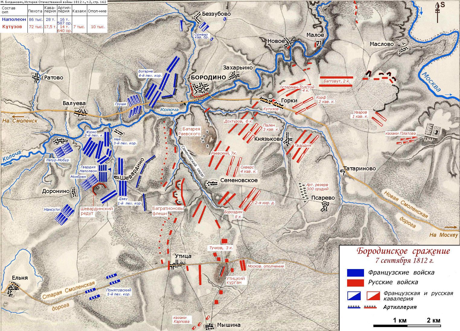
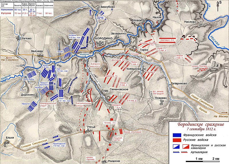
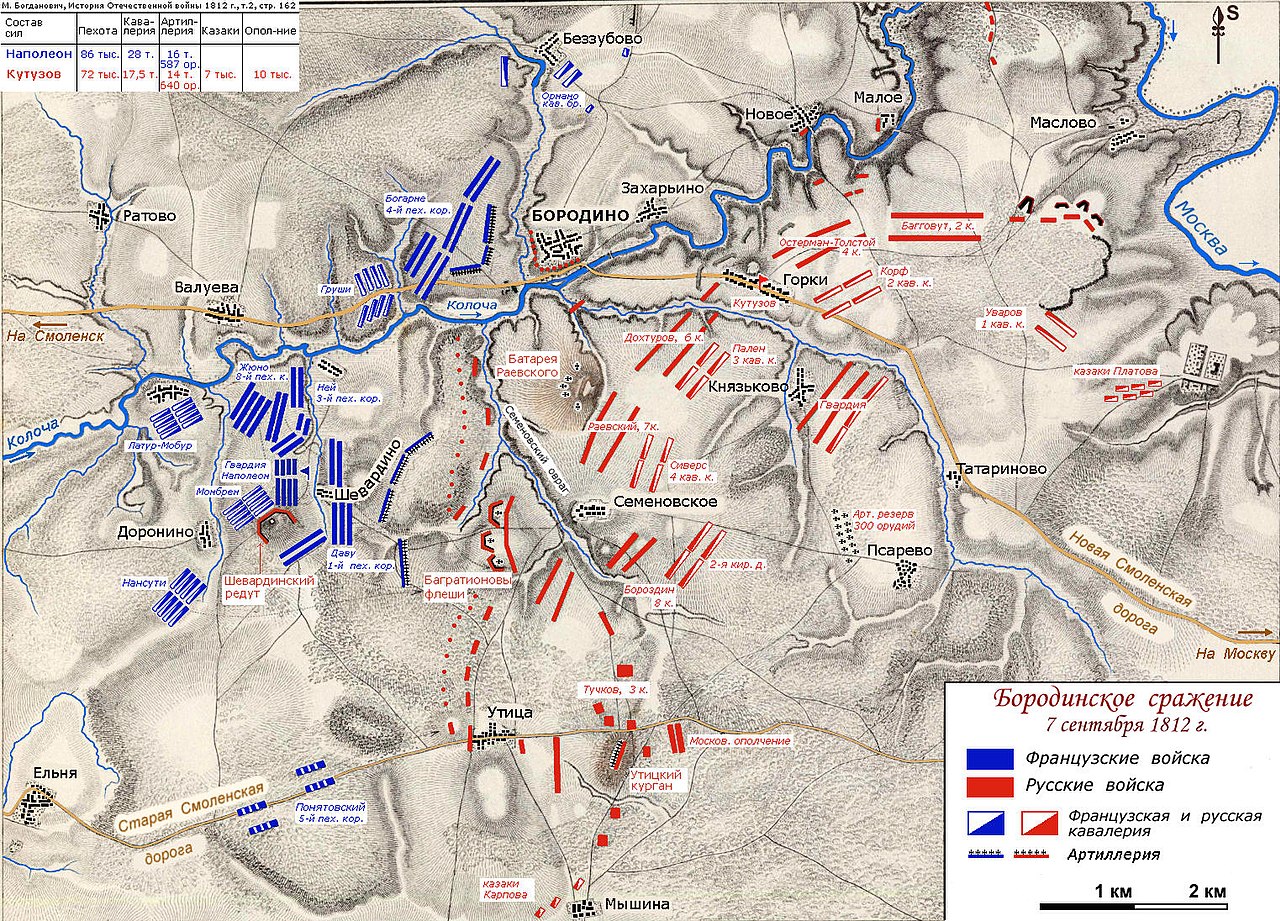
| Description | Map of the troops positions in the morning of September, 7, 1812. Battle of Borodino or Bataille de la Moskowa in french. | ||
| Date | Original in 1850. Modified by Vissarion in 2007. | ||
| Source | Map was drawn on the map from "Atlas to Alison's History of Europe", by Alex. Keith Johnston, published by William Blackwood and Sons in 1850: [1] | ||
| Author | Vissarion | ||
| Permission (Reusing this file) |
|
File history
Click on a date/time to view the file as it appeared at that time.
| Date/Time | Thumbnail | Dimensions | User | Comment | |
|---|---|---|---|---|---|
| current | 11:18, 11 June 2007 | | 1,524 × 1,096 (594 KB) | wikimediacommons>Vissarion | {{Information |Description=Map of the troops positions in the morning of September, 7, 1812. Battle of Borodino or Bataille de la Moskowa in french. |Source=Map was drawn on the map from "Atlas to Alison's History of Europe", by Alex. Keith Johnston, pub |
File usage
There are no pages that use this file.