Alte Niedeck 01.jpg
From Warlike
Size of this preview: 800 × 533 pixels. Other resolutions: 320 × 213 pixels | 640 × 427 pixels | 1,024 × 683 pixels | 1,280 × 853 pixels | 2,560 × 1,707 pixels | 4,176 × 2,784 pixels.
Original file (4,176 × 2,784 pixels, file size: 7.65 MB, MIME type: image/jpeg)
This file is from Wikimedia Commons and may be used by other projects. The description on its file description page there is shown below.
Summary
| DescriptionAlte Niedeck 01.jpg |
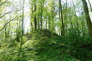
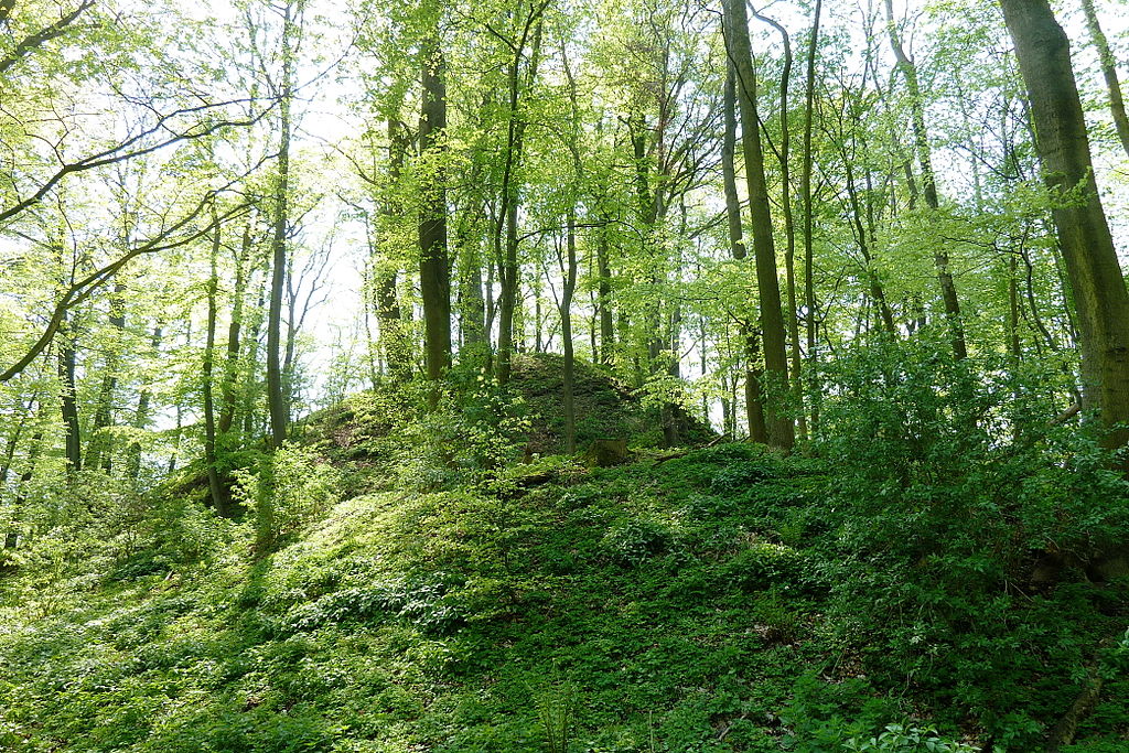
Deutsch: Blick von Norden auf Wall, Graben und den Burghügel der Alten Niedeck, einer Höhenburg aus dem 13. Jahrhundert auf dem Kronenberg bei Niedeck, Gemeinde Gleichen, Südniedersachsen. Die Burg zerfiel zu Beginn des 17. Jahrhunderts, erhalten sind Gräben, Wälle und Versturzhügel, aber keine oberirdischen Mauerreste |
| Date | |
| Source | Own work |
| Author | Jan Stubenitzky (Dehio) |
| Camera location | 51° 30′ 28.39″ N, 10° 04′ 08.89″ E | View this and other nearby images on: OpenStreetMap |
|---|
Licensing
I, the copyright holder of this work, hereby publish it under the following licence:
This file is licensed under the Creative Commons Attribution-Share Alike 3.0 Unported licence.
- You are free:
- to share – to copy, distribute and transmit the work
- to remix – to adapt the work
- Under the following conditions:
- attribution – You must give appropriate credit, provide a link to the licence, and indicate if changes were made. You may do so in any reasonable manner, but not in any way that suggests the licensor endorses you or your use.
- share alike – If you remix, transform, or build upon the material, you must distribute your contributions under the same or compatible licence as the original.
Captions
Add a one-line explanation of what this file represents
Items portrayed in this file
depicts
1 May 2012
51°30'28.39000"N, 10°4'8.89000"E
image/jpeg
b269316ad0b8c1d996a06ac29ad0f6ac61d99542
8,019,342 byte
2,784 pixel
4,176 pixel
0.008 second
3.5
4.1 millimetre
File history
Click on a date/time to view the file as it appeared at that time.
| Date/Time | Thumbnail | Dimensions | User | Comment | |
|---|---|---|---|---|---|
| current | 11:25, 4 September 2013 | 4,176 × 2,784 (7.65 MB) | wikimediacommons>Dehio | User created page with UploadWizard |
File usage
There are no pages that use this file.
Metadata
This file contains additional information, probably added from the digital camera or scanner used to create or digitise it.
If the file has been modified from its original state, some details may not fully reflect the modified file.
| Camera manufacturer | Panasonic |
|---|---|
| Camera model | DMC-TZ10 |
| Exposure time | 1/125 sec (0.008) |
| F Number | f/3.5 |
| ISO speed rating | 80 |
| Date and time of data generation | 14:09, 1 May 2012 |
| Lens focal length | 4.1 mm |
| Latitude | 51° 30′ 28.39″ N |
| Longitude | 10° 4′ 8.89″ E |
| Orientation | Normal |
| Horizontal resolution | 180 dpi |
| Vertical resolution | 180 dpi |
| Software used | GIMP 2.8.0 |
| File change date and time | 14:09, 1 May 2012 |
| Y and C positioning | Co-sited |
| Exposure Program | Normal program |
| Exif version | 2.21 |
| Date and time of digitising | 14:09, 1 May 2012 |
| Meaning of each component |
|
| Image compression mode | 4 |
| APEX exposure bias | 0 |
| Maximum land aperture | 3.44 APEX (f/3.29) |
| Metering mode | Pattern |
| Light source | Unknown |
| Flash | Flash did not fire, compulsory flash suppression |
| Supported Flashpix version | 1 |
| Colour space | sRGB |
| Sensing method | One-chip colour area sensor |
| File source | Digital still camera |
| Scene type | A directly photographed image |
| Custom image processing | Custom process |
| Exposure mode | Auto exposure |
| White balance | Auto white balance |
| Focal length in 35 mm film | 25 mm |
| Scene capture type | Standard |
| Scene control | None |
| Contrast | Normal |
| Saturation | Normal |
| Sharpness | Hard |
| GPS time (atomic clock) | 12:08 |
| Satellites used for measurement | 3 |
| Receiver status | Measurement in progress |
| Measurement mode | 2-dimensional measurement |
| Measurement precision | Good (2.6) |
| Geodetic survey data used | WGS-84 |
| GPS date | 1 May 2012 |
| GPS tag version | 0.0.2.2 |
| Date metadata was last modified | 14:09, 1 May 2012 |
| Keywords |
|
Retrieved from "https://warlike.info/File:Alte_Niedeck_01.jpg"
