Обелиск на братской могиле 27 красноармейцев 1919 Тарасово.jpg
From Warlike
Size of this preview: 800 × 600 pixels. Other resolutions: 320 × 240 pixels | 640 × 480 pixels | 1,024 × 768 pixels | 1,280 × 960 pixels | 2,560 × 1,920 pixels.
Original file (2,560 × 1,920 pixels, file size: 2.41 MB, MIME type: image/jpeg)
Summary
| Description |
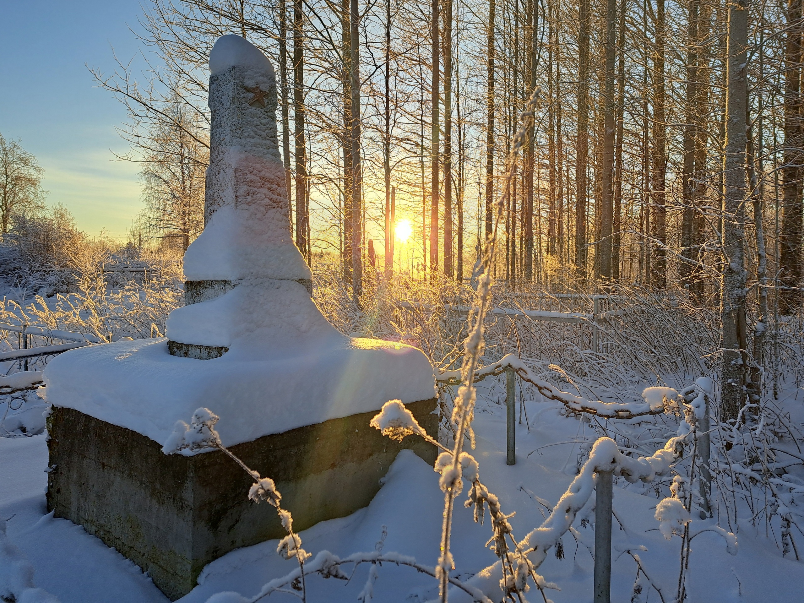
Русский: Обелиск на братской могиле 27 красноармейцев, погибших при взятии села Тарасово Холмогорского уезда Архангельской губернии 25-29 января 1919 года, а также при взятии Порецкой волости 31 января 1919 и при боях за село Средь-Мехреньга в феврале-марте 1919 года. Село Тарасово обороняли солдаты армии Северной области, партизаны Тарасовского белого партизанского отряда и британские солдаты из 17-го батальона Королевского Ливерпульского полка.
|
||||
| Date | 15 января 2023 | ||||
| Source | Own work | ||||
| Author | Kargopolis |
| Camera location | | View this and other nearby images on: OpenStreetMap |
|---|
Licensing
I, the copyright holder of this work, hereby publish it under the following licence:
This file is licensed under the Creative Commons Attribution-Share Alike 4.0 International licence.
- You are free:
- to share – to copy, distribute and transmit the work
- to remix – to adapt the work
- Under the following conditions:
- attribution – You must give appropriate credit, provide a link to the licence, and indicate if changes were made. You may do so in any reasonable manner, but not in any way that suggests the licensor endorses you or your use.
- share alike – If you remix, transform, or build upon the material, you must distribute your contributions under the same or compatible licence as the original.

|
This image was uploaded as part of Wiki Loves Monuments 2023.
|
File history
Click on a date/time to view the file as it appeared at that time.
| Date/Time | Thumbnail | Dimensions | User | Comment | |
|---|---|---|---|---|---|
| current | 02:09, 16 September 2023 | | 2,560 × 1,920 (2.41 MB) | wikimediacommons>Kargopolis | Uploaded own work with UploadWizard |
File usage
There are no pages that use this file.