'Gemini Explorer' in Buckie Harbour - geograph.org.uk - 2088256.jpg
From Warlike
No higher resolution available.
'Gemini_Explorer'_in_Buckie_Harbour_-_geograph.org.uk_-_2088256.jpg (640 × 427 pixels, file size: 79 KB, MIME type: image/jpeg)
Summary
| Description |
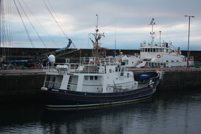
English: Gemini Explorer in Buckie Harbour. Gemini Explorer is an ex Clyde class lifeboat formerly stationed at Clovelly, but now used for dolphin watching cruises on the Moray Firth. |
| Date | |
| Source | From geograph.org.uk; transferred by User:Happysailor using geograph_org2commons. |
| Author | Richard Kay |
| Attribution (required by the licence) | Richard Kay / 'Gemini Explorer' in Buckie Harbour / |
| Camera location | | View this and other nearby images on: OpenStreetMap |
|---|
| Object location | | View this and other nearby images on: OpenStreetMap |
|---|
_region:GB-GBN_heading:292.00&language=en-gb)
Licensing

|
This image was taken from the Geograph GB & Eire project collection. See this photograph's page on the Geograph website for the photographer's contact details. The copyright on this image is owned by Richard Kay, and is licensed for reuse under the Creative Commons Attribution Share-Alike 2.0 license.
|
This file is licensed under the Creative Commons Attribution-Share Alike 2.0 Generic licence.
Attribution:
Richard Kay
- You are free:
- to share – to copy, distribute and transmit the work
- to remix – to adapt the work
- Under the following conditions:
- attribution – You must give appropriate credit, provide a link to the licence, and indicate if changes were made. You may do so in any reasonable manner, but not in any way that suggests the licensor endorses you or your use.
- share alike – If you remix, transform, or build upon the material, you must distribute your contributions under the same or compatible licence as the original.
File history
Click on a date/time to view the file as it appeared at that time.
| Date/Time | Thumbnail | Dimensions | User | Comment | |
|---|---|---|---|---|---|
| current | 20:20, 23 April 2012 | | 640 × 427 (79 KB) | wikimediacommons>File Upload Bot (Magnus Manske) |
File usage
There are no pages that use this file.